James River and Kanawha Canal Historic District

Why it's listed
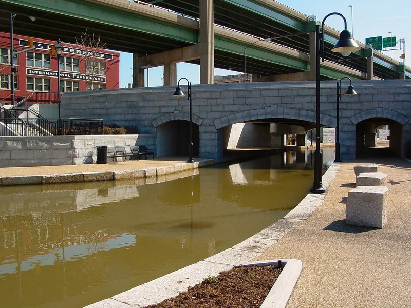
This linear district follows the route of the James River and Kanawha Canal through Richmond and into Henrico County, from the Ship Lock at the foot of Peach Street to the area of Bosher's Dam. It includes earthen canal cuts, granite locks, stone bridges and bridge abutments, basins, culverts, a pumphouse and the towpath. The canal grew from the James River Company, chartered in 1785 with George Washington as honorary president, and was expanded after 1835 by the James River and Kanawha Company. The Tidewater Connection, finished by 1854, used five stone locks to carry larger boats down to tidewater and supported Richmond's port. The nomination praises the locks' chiseled granite ashlar as works of art and calls the canal a major engineering feat. Railroads ended canal traffic after the system was sold in 1880, and tracks were laid on the towpath. Some features have since disappeared or been altered.
Significance in brief: The canal system grew out of efforts led by George Washington's James River Company (chartered 1785) and later the James River and Kanawha Company (1835) to link tidewater Virginia with the west. The nomination describes it as a major engineering feat with considerable historical value. Its Tidewater Connection of five stone locks, essentially complete by 1854, helped the Richmond port rise. Its fine granite ashlar locks were called "works of art" by the canal company.
Machine-generated summary. This summary was generated by a language model from the official nomination document and has not been reviewed line by line by an editor. It may contain errors. Check the source document before relying on any detail. Source: nomination document (PDF) · National Archives catalog entry. NRHP reference 71000982, listed August 26, 1971. Summary generated October 2026 (model claude-sonnet-5-5, prompt v1.0-2026-10-29, confidence medium).
Key facts
| Address | Extends from Ship Locks to Bosher's Dam, Richmond |
|---|---|
| County | Henrico County |
| Listed | August 26, 1971 |
| Reference number | 71000982 |
| Resource type | District |
| Period of significance | 19th Century |
| Areas of significance | Commerce, Engineering, Transportation, Architecture |
| Level of significance | State |
| Status (as stated in the nomination) | Listed as altered, with some features destroyed, covered or missing, such as Lock numbers five and six of the First Grand Division and the Shockoe Creek Aqueduct. The form notes threats from an expressway and plans to incorporate lower locks into an industrial plant. |
| Acreage | 138 |
| Coordinates | 37.54637, -77.50251 (NPS GIS) |
What listing means for this property
This is a historic district. Buildings within its boundary are either contributing (they add to the district's significance) or non-contributing. Owners of contributing income-producing buildings can claim the 20% federal rehabilitation tax credit; homeowners should look at state credits. National Register districts impose no design review by themselves; a local historic district ordinance, if one exists, does (the difference explained).
General information, not legal or tax advice. Rules change; confirm with your State Historic Preservation Office or a qualified adviser.
Sources and further reading
- National Park Service, National Register of Historic Places database (snapshot May 2026), reference 71000982.
- Nomination form (PDF, National Archives) — catalog entry
- Wikidata Q49506670
- This listing as JSON
Last updated October 2026. Found an error? See the editorial policy for how to report it.