Eight-Foot High Speed Tunnel
Also known as: Eight-Foot Transonic Tunnel
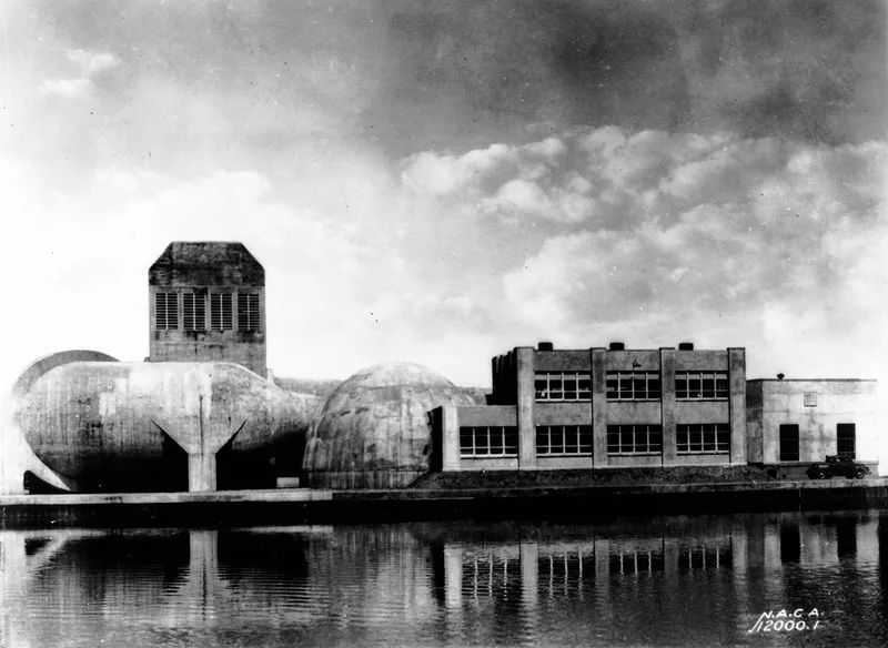

Why it's listed
Eight-Foot High Speed Tunnel is a structure in Hampton, an independent city in Virginia, with reference number 85002798. It was listed in October 1985. The only material available is an administrative locator card from the National Park Service, and it has no physical description, construction date, designer or statement of significance. The card shows that the resource was marked for removal or withdrawal of designation, with a date of 08/25/2014, and it lists a separate update dated 7/29/15. The card gives no cause for the removal. Other fields on the card, such as national landmark status and the multiple-resource or thematic group name, are blank or unreadable in the text. Because of this, nothing can be said here about what the tunnel was used for, who built it, or what qualities led to its original listing. A reader who wants those details would need the full nomination narrative, which is not part of this record.
Significance in brief: The document gives no statement of significance. It is a status card that records a withdrawal or removal of designation dated 08/25/2014, and no reasons are given.
Machine-generated summary. This summary was generated by a language model from the official nomination document and has not been reviewed line by line by an editor. It may contain errors. Check the source document before relying on any detail. Source: nomination document (PDF) · National Archives catalog entry. NRHP reference 85002798, listed October 3, 1985. Summary generated October 2026 (model claude-sonnet-5-5, prompt v1.0-2026-10-29, confidence low).
Key facts
| Address | Langley Research Center, Hampton (Independent City) |
|---|---|
| County | Hampton |
| Listed | October 3, 1985 |
| Reference number | 85002798 |
| Resource type | Structure |
| Areas of significance | Other, Military, Engineering, Science |
| Level of significance | National |
| National Historic Landmark | Yes, designated October 3, 1985 |
| Status (as stated in the nomination) | The locator card records a removal or withdrawal of designation dated 08/25/2014. It does not describe the physical condition or use of the structure. |
| Acreage | 0.9 |
| Coordinates | 37.08226, -76.34118 (NPS GIS) |
What listing means for this property
National Register listing is honorary: it recognises significance and does not restrict what a private owner may do without federal money or permits. It unlocks the 20% federal rehabilitation tax credit for income-producing buildings, state credits in many states, and Section 106 review when federal agencies are involved. See what listing means in practice.
General information, not legal or tax advice. Rules change; confirm with your State Historic Preservation Office or a qualified adviser.
Sources and further reading
- National Park Service, National Register of Historic Places database (snapshot May 2026), reference 85002798.
- Nomination form (PDF, National Archives) — catalog entry
- Wikipedia article (used for cross-checking only; text not reproduced here)
- Wikidata Q5348927
- This listing as JSON
Last updated October 2026. Found an error? See the editorial policy for how to report it.