Woodlawn Plantation (Boundary Increase)
Also known as: DHR File Number: 029-0056

Why it's listed
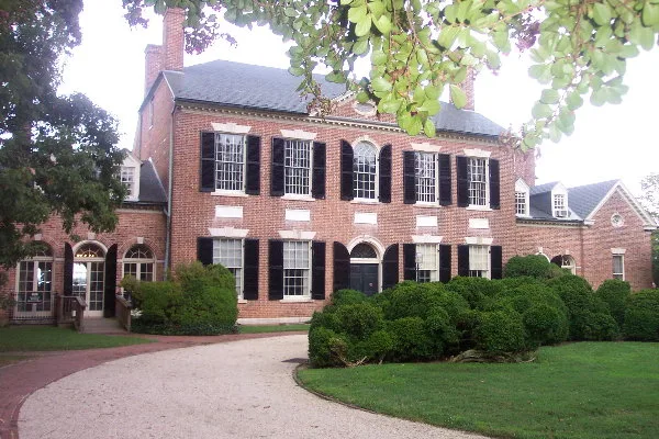
This 2.82-acre tract of open lawn lies along U.S. Route 1 near Alexandria, Virginia, between the Woodlawn mansion grounds and the Woodlawn Quaker Meetinghouse property. It was originally part of the roughly 2,000 acres George Washington gave in 1799 to Eleanor Parke Custis and Major Lawrence Lewis, whose mansion, designed by Dr. William Thornton, was built between 1800 and 1805. In 1846 Quakers bought the land to run a timber farm and 'free labor colony' meant to show that agriculture could succeed without enslaved labor. The tract left Woodlawn in 1869, returned in 1905, and was sold to the federal government in 1919 for Camp Humphreys, now Fort Belvoir. It is the only documented spot on Woodlawn property where a Union Army camp stood between 1861 and 1864. An archaeological site with artifacts contemporary with the mansion, probably a farm outbuilding, is considered noncontributing because utility lines damaged it. The addition reunites the historic core with the meetinghouse property.
Significance in brief: The tract was part of the land George Washington gave to Eleanor Parke Custis and Lawrence Lewis in 1799. It was later part of the Quaker 'free labor colony' and is the only documented location on Woodlawn property where a Union Army camp existed in 1861-1864. Adding it reconnects the Woodlawn mansion with the adjacent Quaker Meetinghouse property.
Machine-generated summary. This summary was generated by a language model from the official nomination document and has not been reviewed line by line by an editor. It may contain errors. Check the source document before relying on any detail. Source: nomination document (PDF) · National Archives catalog entry. NRHP reference 11000836, listed November 18, 2011. Summary generated October 2026 (model claude-sonnet-5-5, prompt v1.0-2026-10-29, confidence medium).
Key facts
| Address | 9000 Richmond Hwy., Alexandria |
|---|---|
| County | Fairfax (city and county) |
| Listed | November 18, 2011 |
| Reference number | 11000836 |
| Resource type | Site |
| Period of significance | 1800-1805 |
| Architect / builder | Thornton, Dr. William |
| Criteria |
|
| Areas of significance | Conservation |
| Level of significance | National |
| Status (as stated in the nomination) | Currently a lawn with young trees, shrubbery and utility poles; no structures stand on it. It is being transferred from the United States Government (Fort Belvoir) to the National Trust for Historic Preservation, with a park use proposed. |
| Acreage | 2.8 |
| Coordinates | 38.71417, -77.14128 (NPS GIS) |
What listing means for this property
Sites (archaeological sites, battlefields, landscapes) are often listed with a restricted address to protect them from looting or disturbance. Listing is honorary for private owners; federal undertakings on or near the site go through Section 106 review, and state laws may protect burials and artefacts regardless of listing.
General information, not legal or tax advice. Rules change; confirm with your State Historic Preservation Office or a qualified adviser.
Sources and further reading
- National Park Service, National Register of Historic Places database (snapshot May 2026), reference 11000836.
- Nomination form (PDF, National Archives) — catalog entry
- Wikipedia article (used for cross-checking only; text not reproduced here)
- Wikidata Q1583426
- This listing as JSON
Last updated October 2026. Found an error? See the editorial policy for how to report it.