Culpeper National Cemetery
Also known as: VDHR File No. 204-000

Why it's listed
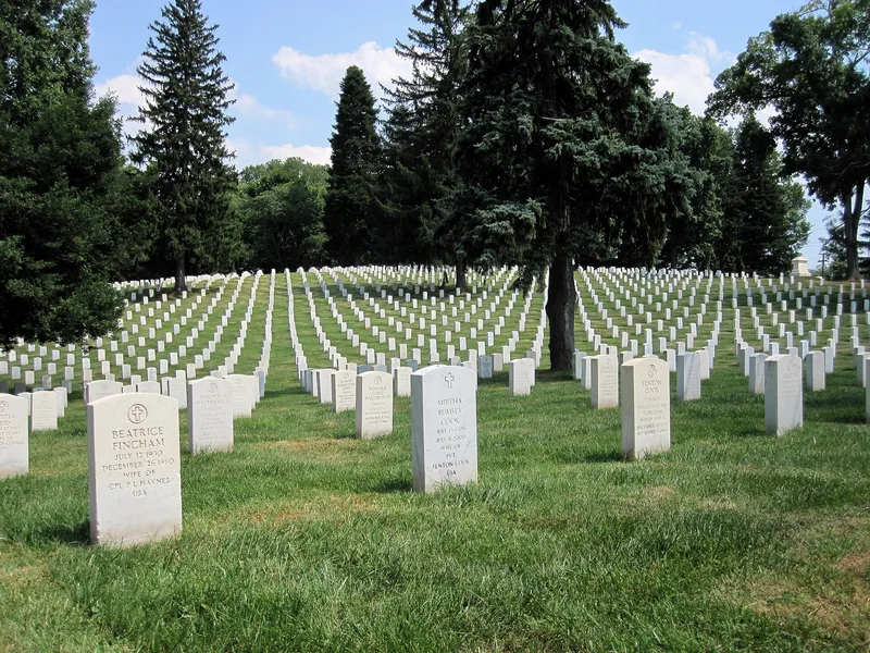
Culpeper National Cemetery occupies a site about half a mile from the county courthouse in Culpeper, Virginia. Established in 1867, it began as a six-acre square enclosed by a brick wall, with an ornamental iron gate, a central circle with a flagpole, and six burial sections. One section holds 912 unknown Civil War soldiers, and remains were gathered from battlefields such as Cedar Mountain, Brandy Station, Trevilians Station and Gordonsville. The grounds include a Second Empire lodge built in 1872 to a design by Quartermaster General Montgomery C. Meigs, plus granite and iron monuments from Pennsylvania, New York, Massachusetts, Maine and Ohio units. A 1978 donation of 10.51 acres added nine sections, and burials continue. The property is recognized for its link to the Civil War in a heavily contested county and for the lodge's distinctive design, with a period of significance from 1866 to 1939.
Significance in brief: The cemetery is tied to the Civil War in the Culpeper area, where many battles and skirmishes occurred and where Union dead were reinterred after the war. Its 1872 lodge is also cited as a distinctive prototype design by Quartermaster General Montgomery C. Meigs.
Machine-generated summary. This summary was generated by a language model from the official nomination document and has not been reviewed line by line by an editor. It may contain errors. Check the source document before relying on any detail. Source: nomination document (PDF) · National Archives catalog entry. NRHP reference 96000029, listed February 26, 1996. Summary generated October 2026 (model claude-sonnet-5-5, prompt v1.0-2026-10-29, confidence high).
Key facts
| Address | 305 U.S. Ave., Culpeper |
|---|---|
| County | Culpeper County |
| Listed | February 26, 1996 |
| Reference number | 96000029 |
| Resource type | Site |
| Period of significance | 1866-1939 |
| Architect / builder | Meigs, Montgomery C. |
| Architectural style | Late Victorian: Second Empire |
| Criteria |
|
| Areas of significance | Architecture |
| Level of significance | National |
| Status (as stated in the nomination) | Interments continue; the cemetery was closed in 1972 and reopened in 1978 after a donation of adjacent land. An administration/maintenance building was added in 1989. |
| Acreage | 17.2 |
| Within district | South East Street Historic District |
| Coordinates | 38.47000, -77.99131 (NPS GIS) |
What listing means for this property
Sites (archaeological sites, battlefields, landscapes) are often listed with a restricted address to protect them from looting or disturbance. Listing is honorary for private owners; federal undertakings on or near the site go through Section 106 review, and state laws may protect burials and artefacts regardless of listing.
General information, not legal or tax advice. Rules change; confirm with your State Historic Preservation Office or a qualified adviser.
Sources and further reading
- National Park Service, National Register of Historic Places database (snapshot May 2026), reference 96000029.
- Nomination form (PDF, National Archives) — catalog entry
- Wikipedia article (used for cross-checking only; text not reproduced here)
- Wikidata Q5193109
- This listing as JSON
Last updated October 2026. Found an error? See the editorial policy for how to report it.