Santee

Why it's listed
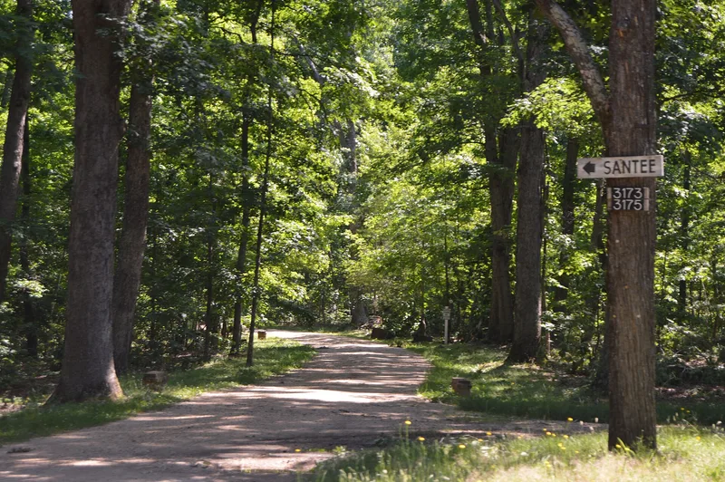
Santee is a plantation house near Corbin in Caroline County, Virginia, reached by a road winding through woods into an antebellum park. The two-story, five-bay brick house, laid in Flemish bond under a low hipped roof, was finished by 1820 for Battaile Fitzhugh, with a frame ell that probably predates it. Inside, a curved stair and finely molded parlor mantels with fluted Doric colonettes and sunburst paterae stand out. Behind the house are the original brick kitchen and an early stable, and several hundred yards east survives one of eight original slave houses. The land was patented by John Battaile I and passed through the Fitzhugh and later Gordon families. Troops of Gen. Stonewall Jackson camped in the woods in the winter of 1862-1863. The house stood vacant from 1931 to 1943 and was restored after 1945. It was listed as an outstanding example of a formal Tidewater plantation, with 56 acres including the park and approach.
Significance in brief: The nomination calls Santee an outstanding example of a formal plantation of early-nineteenth-century Tidewater Virginia. The house, early outbuildings, slave house and park give a glimpse of antebellum life along the Rappahannock River at its most prosperous. The property was associated with the Fitzhugh and Gordon families for over 250 years.
Machine-generated summary. This summary was generated by a language model from the official nomination document and has not been reviewed line by line by an editor. It may contain errors. Check the source document before relying on any detail. Source: nomination document (PDF) · National Archives catalog entry. NRHP reference 79003034, listed May 7, 1979. Summary generated October 2026 (model claude-sonnet-5-5, prompt v1.0-2026-10-29, confidence medium).
Key facts
| Address | Off VA 610, Corbin |
|---|---|
| County | Caroline County |
| Listed | May 7, 1979 |
| Reference number | 79003034 |
| Resource type | Building |
| Period of significance | 1800-1899 |
| Areas of significance | Military, Architecture, Social History |
| Level of significance | State |
| Status (as stated in the nomination) | Occupied as a private residence and used for agriculture; described as remarkably well preserved and restored by the owners who bought it in 1945. It was vacant from 1931 until 1943. |
| Acreage | 56 |
| Coordinates | 38.21536, -77.36199 (NPS GIS) |
What listing means for this property
National Register listing is honorary: it recognises significance and does not restrict what a private owner may do without federal money or permits. It unlocks the 20% federal rehabilitation tax credit for income-producing buildings, state credits in many states, and Section 106 review when federal agencies are involved. See what listing means in practice.
General information, not legal or tax advice. Rules change; confirm with your State Historic Preservation Office or a qualified adviser.
Sources and further reading
- National Park Service, National Register of Historic Places database (snapshot May 2026), reference 79003034.
- Nomination form (PDF, National Archives) — catalog entry
- Wikipedia article (used for cross-checking only; text not reproduced here)
- Wikidata Q14713177
- This listing as JSON
Last updated October 2026. Found an error? See the editorial policy for how to report it.