Middlebrook Historic District

Why it's listed
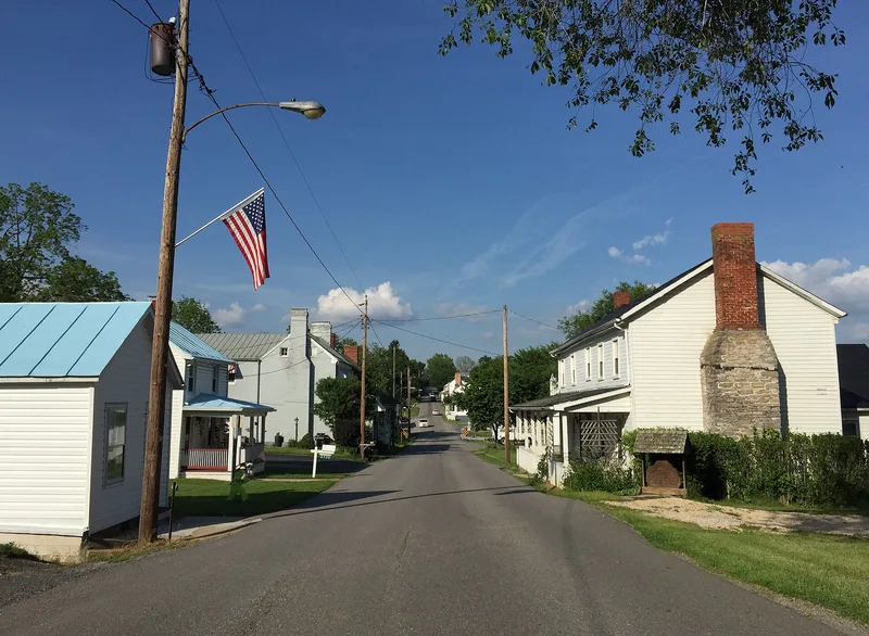
Middlebrook is a small village in the Valley of Virginia, ten miles southwest of Staunton, platted in 1799 along the road to Lexington. The road became a turnpike by 1851, and the village grew into the largest in Augusta County by 1882, with 274 residents. Two rows of closely spaced log and frame houses, brick "I"-houses, stores, churches and an Odd Fellows Hall still line the main street much as they did in the 1880s. When the Valley Turnpike and railroads favored neighboring Greenville, Middlebrook declined, and little was built or remodeled afterward. That preserved the original lot pattern and its vernacular buildings. The district also contains archaeological sites of shops, factories, tanyards and homes. Among them are the remains of a black community that developed on the west side of town in the late 19th century, which could show how life changed after emancipation. A 1925 garage and two early 20th-century school buildings add later layers.
Significance in brief: The nomination argues Middlebrook is one of the oldest and best-preserved rural villages in Augusta County, with 19th-century vernacular architecture still arranged on its original plat. Its decline after 1900 left little new building. Archaeological sites document commercial and industrial activity and a black community that developed at the west end of the village after emancipation.
Machine-generated summary. This summary was generated by a language model from the official nomination document and has not been reviewed line by line by an editor. It may contain errors. Check the source document before relying on any detail. Source: nomination document (PDF) · National Archives catalog entry. NRHP reference 83003259, listed February 10, 1983. Summary generated October 2026 (model claude-sonnet-5-5, prompt v1.0-2026-10-29, confidence medium).
Key facts
| Address | Jct. VA 252 and 876, Middlebrook |
|---|---|
| County | Augusta County |
| Listed | February 10, 1983 |
| Reference number | 83003259 |
| Resource type | District |
| Period of significance | 1700-1799, 1800-1899 (boxes checked for these centuries; 1900- not marked) |
| Architectural style | Local vernacular architecture: log hall/parlor cabins and "I"-houses, with Eastlake porches and neocolonial and bungalow elements |
| Areas of significance | Commerce, Historic - Non-Aboriginal, Black, Exploration/Settlement, Architecture |
| Level of significance | State |
| Status (as stated in the nomination) | Described as largely unaltered, with little building activity in the 20th century. Only the Baptist church of the two surviving historic churches is still in use. |
| Acreage | 62 |
| Coordinates | 38.05207, -79.21456 (NPS GIS) |
What listing means for this property
This is a historic district. Buildings within its boundary are either contributing (they add to the district's significance) or non-contributing. Owners of contributing income-producing buildings can claim the 20% federal rehabilitation tax credit; homeowners should look at state credits. National Register districts impose no design review by themselves; a local historic district ordinance, if one exists, does (the difference explained).
General information, not legal or tax advice. Rules change; confirm with your State Historic Preservation Office or a qualified adviser.
Sources and further reading
- National Park Service, National Register of Historic Places database (snapshot May 2026), reference 83003259.
- Nomination form (PDF, National Archives) — catalog entry
- Wikipedia article (used for cross-checking only; text not reproduced here)
- Wikidata Q14712837
- This listing as JSON
Last updated October 2026. Found an error? See the editorial policy for how to report it.