Contrabands and Freedmen Cemetery
Also known as: Site #44AX0179/VDHR # 100-0121-1085
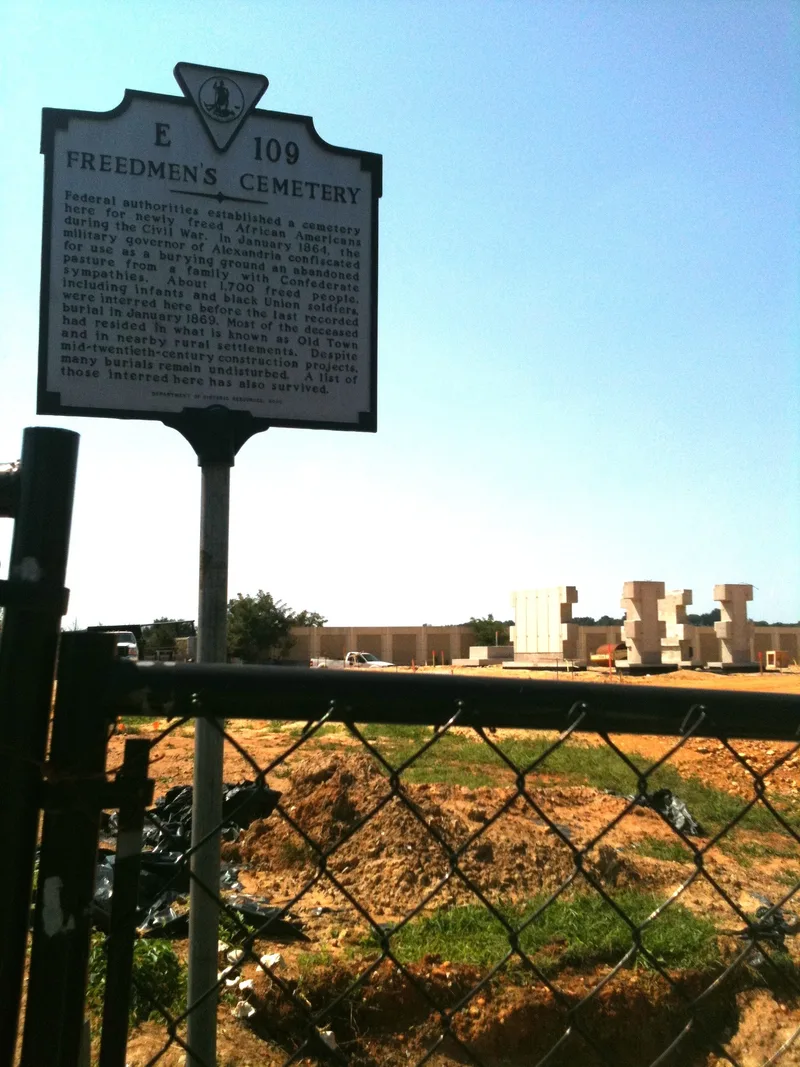

Why it's listed
At the corner of South Washington and Church streets in Alexandria, an open, fenced lot conceals a Civil War-era burial ground for African Americans. The federal government operated it from March 1864 to January 1869, and records name 1,711 people buried there, more than half of them children under ten. Many had fled slavery and arrived in Union-occupied Alexandria seeking freedom. Later a gas station, a commercial building, street construction and the Capital Beltway cut into parts of the grounds, and the cemetery was largely forgotten until research in the late twentieth century. Archaeologists have mapped 541 graves in orderly rows, along with an unburied lane that probably served as a carriage path. Hundreds more graves are expected under slabs and pavement. Excavations also recovered 4,210 stone artifacts from Native American visits, including a Clovis point, dating from as early as 13,000 years ago. Protective fill now covers the graves.
Significance in brief: The cemetery holds 1,711 recorded burials of formerly enslaved people who came to Union-occupied Alexandria seeking freedom, and it documents African American ethnic and social history. Archaeology has located 541 graves and a carriage path, and the grave locations are expected to remain largely intact. The site also yielded 4,210 Native American artifacts, including a Clovis point, showing use from about 11,000 B.C. to 900 A.D.
Machine-generated summary. This summary was generated by a language model from the official nomination document and has not been reviewed line by line by an editor. It may contain errors. Check the source document before relying on any detail. Source: nomination document (PDF) · National Archives catalog entry. NRHP reference 12000516, listed August 15, 2012. Summary generated October 2026 (model claude-sonnet-5-5, prompt v1.0-2026-10-29, confidence high).
Key facts
| Address | 1001 S. Washington St., Alexandria (Independent City) |
|---|---|
| County | Alexandria |
| Listed | August 15, 2012 |
| Reference number | 12000516 |
| Resource type | Site |
| Period of significance | 11,000 BC - 900 AD; 1864-1869 |
| Criteria |
|
| Areas of significance | Prehistoric, Historic - Non-Aboriginal, Black, Social History |
| Level of significance | National, Local |
| Status (as stated in the nomination) | Open, fenced ground covered with protective fill; two concrete slabs from demolished twentieth-century buildings remain to protect graves. A memorial is planned for 2012-2013. |
| Acreage | 1.3 |
| Within district | Alexandria Historic District |
| Coordinates | 38.79449, -77.04991 (NPS GIS) |
What listing means for this property
Sites (archaeological sites, battlefields, landscapes) are often listed with a restricted address to protect them from looting or disturbance. Listing is honorary for private owners; federal undertakings on or near the site go through Section 106 review, and state laws may protect burials and artefacts regardless of listing.
General information, not legal or tax advice. Rules change; confirm with your State Historic Preservation Office or a qualified adviser.
Sources and further reading
- National Park Service, National Register of Historic Places database (snapshot May 2026), reference 12000516.
- Nomination form (PDF, National Archives) — catalog entry
- Wikipedia article (used for cross-checking only; text not reproduced here)
- Wikidata Q5165631
- This listing as JSON
Last updated October 2026. Found an error? See the editorial policy for how to report it.