Fort Davis National Historic Site

Why it's listed
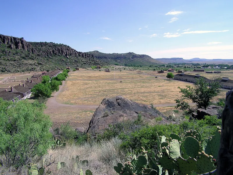
Fort Davis National Historic Site covers 460 acres beside the town of Fort Davis, Texas, in and around Hospital Canyon. It preserves two army posts. The first, built in 1854 of log, plank and adobe, was abandoned in 1861. The second, built from 1867 in stone and adobe, operated until 1891. Its surviving and documented buildings include a row of thirteen officers' quarters, several large barracks, a hospital, a commissary, corrals and a water system. Many of these now exist only as foundations, though some quarters and barracks have been preserved or restored, and one barracks serves as the visitor center. The fort was positioned to command the El Paso Road, the Great Comanche War Trail and Apache routes toward Mexico. After the Civil War it was staffed mainly by four regiments of black soldiers and took part in the 1879-1880 campaign against Victorio. The post was abandoned in 1891, after cattlemen had begun settling the area.
Significance in brief: Fort Davis was strategically placed to command the trans-Pecos part of the El Paso Road, the southern stem of the Great Comanche War Trail, and Apache routes toward Mexico and the Rio Grande crossings. After the Civil War it was rebuilt in stone and adobe and staffed mainly by four regiments of black 'buffalo' soldiers. It played a major role in the 1879-1880 campaign against Victorio and the Warm Springs Apaches.
Machine-generated summary. This summary was generated by a language model from the official nomination document and has not been reviewed line by line by an editor. It may contain errors. Check the source document before relying on any detail. Source: nomination document (PDF) · National Archives catalog entry. NRHP reference 66000045, listed October 15, 1966. Summary generated October 2026 (model claude-sonnet-5-5, prompt v1.0-2026-10-29, confidence medium).
Key facts
| Address | Jct. of TX 17 and 118, Fort Davis |
|---|---|
| County | Jeff Davis County |
| Listed | October 15, 1966 |
| Reference number | 66000045 |
| Resource type | Site |
| Areas of significance | Military, Exploration/Settlement |
| Level of significance | National |
| National Historic Landmark | Yes, designated December 19, 1960 |
| Status (as stated in the nomination) | Publicly owned by the National Park Service and used as a park and museum. Most buildings survive only as foundations or ruins, while several officers' quarters and barracks have been preserved or restored. The visitor center is housed in a restored barracks. |
| Acreage | 460 |
| Coordinates | 30.59883, -103.89543 (NPS GIS) |
What listing means for this property
Sites (archaeological sites, battlefields, landscapes) are often listed with a restricted address to protect them from looting or disturbance. Listing is honorary for private owners; federal undertakings on or near the site go through Section 106 review, and state laws may protect burials and artefacts regardless of listing.
General information, not legal or tax advice. Rules change; confirm with your State Historic Preservation Office or a qualified adviser.
Sources and further reading
- National Park Service, National Register of Historic Places database (snapshot May 2026), reference 66000045.
- Nomination form (PDF, National Archives) — catalog entry
- Wikipedia article (used for cross-checking only; text not reproduced here)
- Wikidata Q5471027
- This listing as JSON
Last updated October 2026. Found an error? See the editorial policy for how to report it.