Independence Park
Also known as: James McCullough Park

Why it's listed
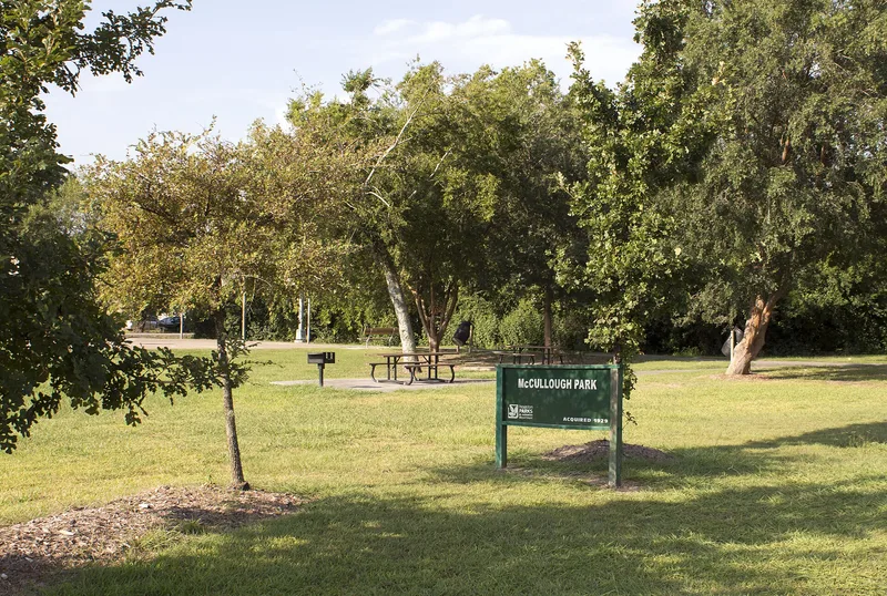
Independence Park is a large open space of roughly eight lots in the 1000 block of East 40th Street in the Independence Heights neighborhood of Houston. The Wright Land Company set it aside in 1910 as a community park for the subdivision's residents. It became the principal meeting place for the community, hosting church gatherings, school activities and annual Juneteenth celebrations. During the 1910s and 1920s, African Americans in Houston had few public parks open to them, and segregation of public spaces was written into local ordinance in 1922. Dedicated park land in a Black community was uncommon. The City of Houston renamed it James McCullough Park after annexing the area in 1929. Today the park remains largely undeveloped, with mature deciduous trees in its western half. The city has recently added a basketball court, baseball field and playground equipment, though these do not detract from its open character. It is the only public space surviving from the early years of Independence Heights.
Significance in brief: It is the only public space remaining from the early years of Independence Heights. It served as the main community gathering place for churches, schools and Juneteenth celebrations. It is a rare example of park provision and planning for African Americans, at a time when few public parks were open to them.
Machine-generated summary. This summary was generated by a language model from the official nomination document and has not been reviewed line by line by an editor. It may contain errors. Check the source document before relying on any detail. Source: nomination document (PDF) · National Archives catalog entry. NRHP reference 97000544, listed June 4, 1997. Summary generated October 2026 (model claude-sonnet-5-5, prompt v1.0-2026-10-29, confidence high).
Key facts
| Address | Roughly bounded by 1000 Blk. of E. 40th St., Houston |
|---|---|
| County | Harris County |
| Listed | June 4, 1997 |
| Reference number | 97000544 |
| Resource type | Site |
| Period of significance | 1910-1947 |
| Architectural style | No style |
| Criteria |
|
| Areas of significance | Community Planning and Development, Black |
| Level of significance | Local |
| Status (as stated in the nomination) | Still used for outdoor recreation; a basketball court, baseball field and playground equipment were recently added by the City of Houston. |
| Acreage | 0.9 |
| Coordinates | 29.82266, -95.38651 (NPS GIS) |
What listing means for this property
Sites (archaeological sites, battlefields, landscapes) are often listed with a restricted address to protect them from looting or disturbance. Listing is honorary for private owners; federal undertakings on or near the site go through Section 106 review, and state laws may protect burials and artefacts regardless of listing.
General information, not legal or tax advice. Rules change; confirm with your State Historic Preservation Office or a qualified adviser.
Sources and further reading
- National Park Service, National Register of Historic Places database (snapshot May 2026), reference 97000544.
- Nomination form (PDF, National Archives) — catalog entry
- Wikipedia article (used for cross-checking only; text not reproduced here)
- Wikidata Q6016147
- This listing as JSON
Last updated October 2026. Found an error? See the editorial policy for how to report it.