Independence Heights Residential Historic District

Why it's listed
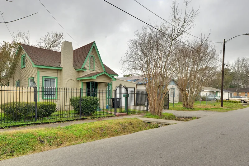
Covering roughly 70 acres in the southwest part of Independence Heights in Houston, this district is made up mostly of small, one-story wood-frame houses set on narrow streets with irregular setbacks. Shotguns, L-plan, pyramidal-roof and center-passage houses appear, but simple gable-front and side-gable bungalows are the most common type. Most were built between about 1908 and the 1920s. The land was part of a 329-acre subdivision platted in 1910 by the Wright Land Company, which marketed lots to African Americans who could not get conventional bank loans and financed sales at reduced interest. The large number of bungalows sets the area apart from the contemporary Third, Fourth and Fifth Wards of Houston and reflects a middle-class community. Early residents included two of the town's mayors, Arthur McCullough and O.L. Hubbard. Of 234 resources, 125 contribute to the district's character. It was listed as the most intact collection of early houses from the original subdivision.
Significance in brief: The nomination argues the district is the most intact collection of early houses from the original African American subdivision, platted in 1910 by the Wright Land Company. It is significant for Ethnic Heritage (Black) and Community Planning and Development under Criterion A, and for Architecture under Criterion C because of its bungalows and traditional house forms that reflect a middle-class community.
Machine-generated summary. This summary was generated by a language model from the official nomination document and has not been reviewed line by line by an editor. It may contain errors. Check the source document before relying on any detail. Source: nomination document (PDF) · National Archives catalog entry. NRHP reference 97000542, listed June 4, 1997. Summary generated October 2026 (model claude-sonnet-5-5, prompt v1.0-2026-10-29, confidence high).
Key facts
| Address | Roughly bounded by N. Yale and E. 34th Sts., and I-610, Houston |
|---|---|
| County | Harris County |
| Listed | June 4, 1997 |
| Reference number | 97000542 |
| Resource type | District |
| Period of significance | 1908-1947 |
| Architect / builder | Chryar, W.H.; Bland, Leroy; Beverly, J.S. (builders) |
| Architectural style | Late 19th and Early 20th Century American Movements: Bungalow/Craftsman |
| Criteria |
|
| Areas of significance | Architecture, Community Planning and Development, Black |
| Level of significance | Local |
| Status (as stated in the nomination) | Current function is single-family dwellings, a mix of rental and owner-occupied housing; a few properties are vacant and neglected. 125 resources contribute and 109 do not. |
| Acreage | 70 |
| Coordinates | 29.81631, -95.39640 (NPS GIS) |
What listing means for this property
This is a historic district. Buildings within its boundary are either contributing (they add to the district's significance) or non-contributing. Owners of contributing income-producing buildings can claim the 20% federal rehabilitation tax credit; homeowners should look at state credits. National Register districts impose no design review by themselves; a local historic district ordinance, if one exists, does (the difference explained).
General information, not legal or tax advice. Rules change; confirm with your State Historic Preservation Office or a qualified adviser.
Sources and further reading
- National Park Service, National Register of Historic Places database (snapshot May 2026), reference 97000542.
- Nomination form (PDF, National Archives) — catalog entry
- Wikipedia article (used for cross-checking only; text not reproduced here)
- Wikidata Q60750300
- This listing as JSON
Last updated October 2026. Found an error? See the editorial policy for how to report it.