Resaca de la Palma Battlefield

Why it's listed
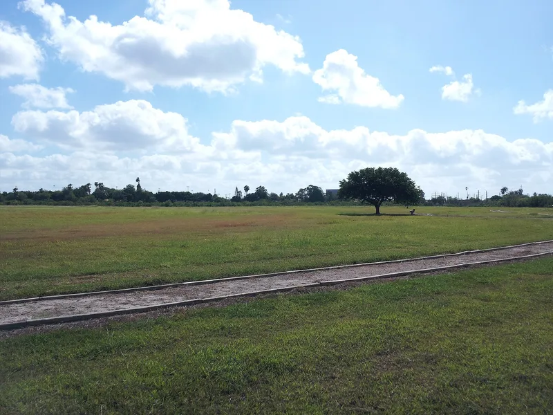
Resaca de la Palma Battlefield is a 50-acre site on the northern edge of Brownsville, Texas, where American and Mexican armies fought on May 9, 1846. The day after the Battle of Palo Alto, Mexican forces under General Arista made a stand along a resaca, or old river bend. Artillery was slowed by thick wire grass, so General Zachary Taylor ordered Captain May's dragoons to charge. The Mexican line broke, Arista narrowly escaped capture, and the army fled toward the Rio Grande, leaving behind its artillery and supplies. The engagement was one of only two important battles of the Mexican War fought on what is now American soil, and it led to the American invasion of Mexico. Today the dense chaparral is gone and the ground is an open polo field, with surrounding areas developed for housing. The resaca has been excavated and holds water again, tall palms remain, and a Texas Centennial Commission monument marks the site. The remaining open land serves as a commemorative setting.
Significance in brief: The battle was one of only two important battles of the Mexican War fought on what is now American soil. General Zachary Taylor's cavalry charge captured Mexican artillery and forced the Mexican army back across the Rio Grande. The victory opened the way for the invasion of Mexico and raised American military prestige.
Machine-generated summary. This summary was generated by a language model from the official nomination document and has not been reviewed line by line by an editor. It may contain errors. Check the source document before relying on any detail. Source: nomination document (PDF) · National Archives catalog entry. NRHP reference 66000813, listed October 15, 1966. Summary generated October 2026 (model claude-sonnet-5-5, prompt v1.0-2026-10-29, confidence medium).
Key facts
| Address | N edge of Brownsville on Parades Line Rd., Brownsville |
|---|---|
| County | Cameron County |
| Listed | October 15, 1966 |
| Reference number | 66000813 |
| Resource type | Site |
| Period of significance | 1846 |
| Areas of significance | Military |
| Level of significance | National |
| National Historic Landmark | Yes, designated December 19, 1960 |
| Status (as stated in the nomination) | The site is an open field used for polo, with the resaca re-excavated and holding water again. The form says surrounding areas are heavily developed, though this portion keeps some commemorative value. |
| Acreage | 50 |
| Coordinates | 25.93744, -97.48625 (NPS GIS) |
What listing means for this property
Sites (archaeological sites, battlefields, landscapes) are often listed with a restricted address to protect them from looting or disturbance. Listing is honorary for private owners; federal undertakings on or near the site go through Section 106 review, and state laws may protect burials and artefacts regardless of listing.
General information, not legal or tax advice. Rules change; confirm with your State Historic Preservation Office or a qualified adviser.
Sources and further reading
- National Park Service, National Register of Historic Places database (snapshot May 2026), reference 66000813.
- Nomination form (PDF, National Archives) — catalog entry
- Wikipedia article (used for cross-checking only; text not reproduced here)
- Wikidata Q7314917
- This listing as JSON
Last updated October 2026. Found an error? See the editorial policy for how to report it.