Ramcat Historic District
Also known as: Schuylkill Historic District

Why it's listed
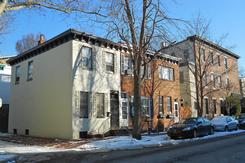
A working-class district on Philadelphia's Schuylkill River edge, where factories, delivery garages and rowhouses were built side by side from the early nineteenth century onward. Its western blocks hold rail-side plants, including the seven-story classical Wanamaker delivery garage at 24th and Walnut, the terra cotta Gimbel garage at 24th and Chestnut, and reinforced concrete works by William Steele and Co. Eastward, two-story brick rowhouses line streets such as 24th Street; some on the 200 block of South 24th date from the 1830s, and late-Victorian houses of the 1880s stand at the south end. The Irish community that settled here before 1850 became known for ethnic segregation, and the nickname "Devil's Pocket" was used alongside "Ramcat." Its orientation toward the river, its mix of industry and housing, and its contrast with the wealthier Rittenhouse neighborhood to the east give it a distinct character in the city. Of 710 buildings, about 87 percent are significant or contributing, and the district's architecture and social history are the basis for its significance.
Significance in brief: Its combination of workplaces and workers' housing is presented as representative of nineteenth-century working-class Philadelphia. The district is also described as an early center of Irish settlement with clear ethnic segregation, and as a community whose industries changed from port and building trades to manufacturing and department store transport.
Machine-generated summary. This summary was generated by a language model from the official nomination document and has not been reviewed line by line by an editor. It may contain errors. Check the source document before relying on any detail. Source: nomination document (PDF) · National Archives catalog entry. NRHP reference 86000055, listed January 8, 1986. Summary generated October 2026 (model claude-haiku-5-5, prompt v1.1-2026-10-29, confidence medium).
Key facts
| Address | Roughly bounded by Market, Twenty-third, and Bainbridge Sts., and RR yards, Philadelphia |
|---|---|
| County | Philadelphia |
| Listed | January 8, 1986 |
| Reference number | 86000055 |
| Resource type | District |
| Period of significance | 1832-1928 |
| Architect / builder | Various |
| Architectural style | Late Federal, late Victorian and Colonial Revival (as stated for individual buildings) |
| Areas of significance | Industry, European, Architecture |
| Level of significance | Local |
| Status (as stated in the nomination) | Overall condition is recorded as excellent. |
| Acreage | 48 |
| Coordinates | 39.94967, -75.18091 (NPS GIS) |
What listing means for this property
This is a historic district. Buildings within its boundary are either contributing (they add to the district's significance) or non-contributing. Owners of contributing income-producing buildings can claim the 20% federal rehabilitation tax credit; homeowners should look at state credits. National Register districts impose no design review by themselves; a local historic district ordinance, if one exists, does (the difference explained).
General information, not legal or tax advice. Rules change; confirm with your State Historic Preservation Office or a qualified adviser.
Sources and further reading
- National Park Service, National Register of Historic Places database (snapshot May 2026), reference 86000055.
- Nomination form (PDF, National Archives) — catalog entry
- Wikipedia article (used for cross-checking only; text not reproduced here)
- Wikidata Q7289278
- This listing as JSON
Last updated October 2026. Found an error? See the editorial policy for how to report it.