Fetter's Mill Village Historic District
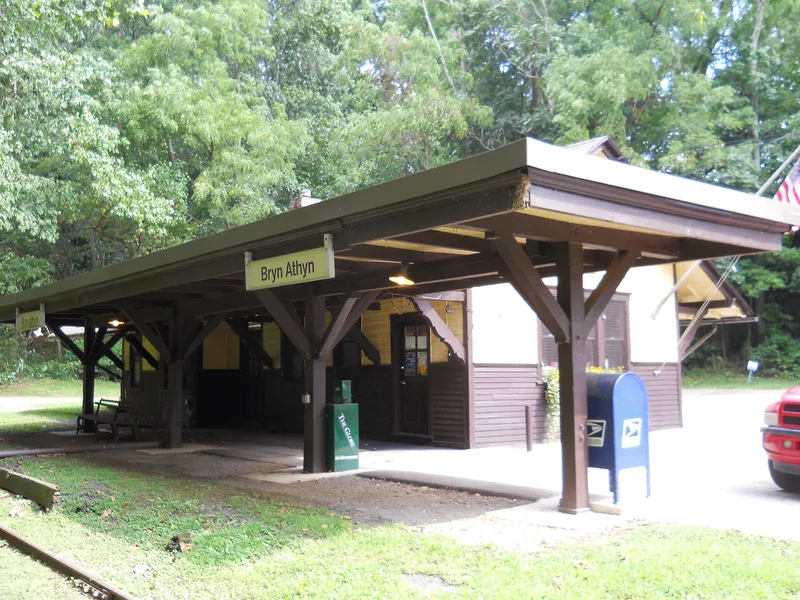
Also known as: Bryn Athyn Station

Why it's listed
Fetter's Mill Village is a cluster of stone, stucco and frame buildings in a wooded valley along Pennypack Creek, with its earliest parts dating to about 1740. A grist mill was built there by Joshua Morris for Quaker investors from Abington, and the farmhouse, barn and wagon shed were in place by 1798. The railroad reached the village in 1878, bringing a station that opened around 1891 and was replaced in 1902. After milling ceased in the late 1890s, artists rented and bought the empty buildings, and John R. Conner painted and taught in the wagon shed between 1914 and 1931. Louis Ewald kept a studio in the mill for decades. The district's buildings, iron bridge of 1883, and rural setting are valued for their intact condition and for showing how a mill village became a rail-served artists' colony.
Significance in brief: The district is argued to be locally significant for its association with art, industry and transportation. Its mill operated from about 1740 until the late 1890s, the railroad arrived in 1878, and artists including Louis Ewald and John R. Conner worked in the village in the early twentieth century, making it a notable artist enclave.
Machine-generated summary. This summary was generated by a language model from the official nomination document and has not been reviewed line by line by an editor. It may contain errors. Check the source document before relying on any detail. Source: nomination document (PDF) · National Archives catalog entry. NRHP reference 05001212, listed August 16, 2006. Summary generated October 2026 (model claude-haiku-5-5, prompt v1.1-2026-10-29, confidence medium).
Key facts
| Address | Fetter's Mill Rd. and Pennypack Ln., Byrn Athyn Borough |
|---|---|
| County | Montgomery County |
| Listed | August 16, 2006 |
| Reference number | 05001212 |
| Resource type | District |
| Period of significance | C. 1740-1954 |
| Architectural style | Colonial; Federal |
| Criteria |
|
| Areas of significance | Art, Industry, Transportation |
| Level of significance | Local |
| Acreage | 7 |
| Coordinates | 40.13201, -75.07126 (NPS GIS) |
What listing means for this property
This is a historic district. Buildings within its boundary are either contributing (they add to the district's significance) or non-contributing. Owners of contributing income-producing buildings can claim the 20% federal rehabilitation tax credit; homeowners should look at state credits. National Register districts impose no design review by themselves; a local historic district ordinance, if one exists, does (the difference explained).
General information, not legal or tax advice. Rules change; confirm with your State Historic Preservation Office or a qualified adviser.
Sources and further reading
- National Park Service, National Register of Historic Places database (snapshot May 2026), reference 05001212.
- Nomination form (PDF, National Archives) — catalog entry
- Wikipedia article (used for cross-checking only; text not reproduced here)
- Wikidata Q5445972
- This listing as JSON
Last updated October 2026. Found an error? See the editorial policy for how to report it.