Brown, John, House

Why it's listed
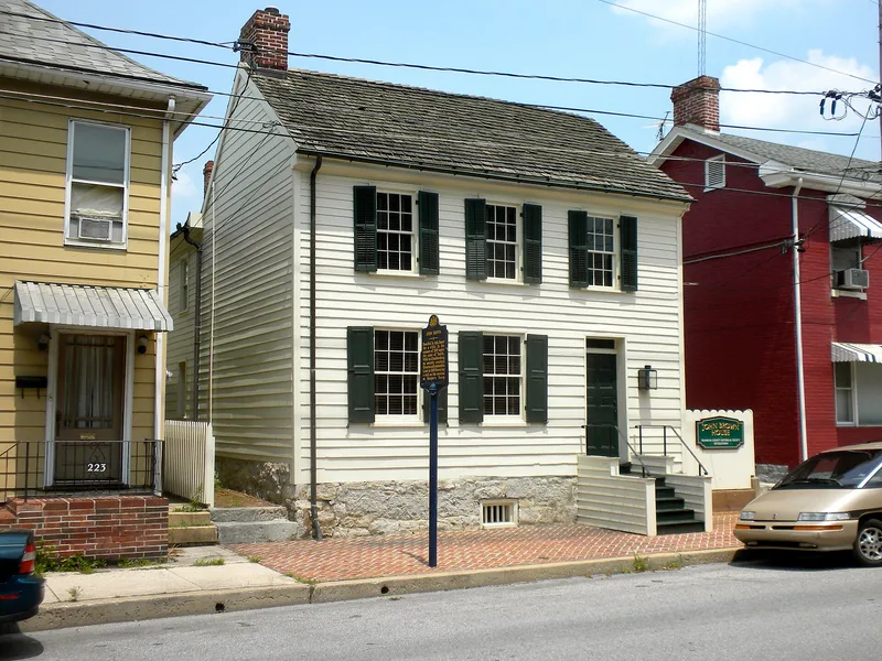
A two-and-a-half-story house on East King Street in Chambersburg, Pennsylvania, with a hewn-log core beneath later clapboards and a stone foundation. Its earliest section is thought to date from about 1820 to 1840, and it was extended to the rear over time. Abolitionist John Brown rented an upstairs bedroom here from June to mid-October 1859, living under the name Dr. Isaac Smith and claiming to be developing iron mines. During this stay he formulated plans and gathered tools and weapons for his attack on the federal armory at Harpers Ferry, Virginia, on October 16, 1859. Equipment was bought from the Lemnos Edge Tool Works and stored at the Oaks and Cauffman Warehouse before being moved to the Kennedy Farm. The house sits half a city block from the Cumberland Valley Railroad station. Frederick Douglass, Shields Green and J. Henry Kagi were among those who met Brown here to discuss the raid.
Significance in brief: The nomination argues the house is significant because abolitionist John Brown lived there in 1859 while formulating and equipping his raid on Harpers Ferry. It states that Brown rented an upstairs bedroom under an assumed name and that visitors who discussed the plans there included Frederick Douglass and other abolitionist leaders.
Machine-generated summary. This summary was generated by a language model from the official nomination document and has not been reviewed line by line by an editor. It may contain errors. Check the source document before relying on any detail. Source: nomination document (PDF) · National Archives catalog entry. NRHP reference 70000548, listed March 5, 1970. Summary generated October 2026 (model claude-haiku-5-5, prompt v1.1-2026-10-29, confidence medium).
Key facts
| Address | 225 E. King St., Chambersburg |
|---|---|
| County | Franklin County |
| Listed | March 5, 1970 |
| Reference number | 70000548 |
| Resource type | Building |
| Period of significance | 1859 |
| Areas of significance | Social History |
| Level of significance | National |
| Status (as stated in the nomination) | The house was slated for demolition as part of the King Street Urban Renewal Project, with razing scheduled for the first quarter of 1970; the document states the house has been in continuous use as a residence. |
| Acreage | 0.9 |
| Coordinates | 39.93898, -77.65917 (NPS GIS) |
What listing means for this property
National Register listing is honorary for a privately owned home: it does not by itself restrict what an owner may do with their own money, and it does not require public access. Restrictions come from local landmark or historic-district ordinances, which are separate (how they differ).
Owner-occupied houses are not eligible for the 20% federal rehabilitation tax credit, which applies to income-producing buildings, but many states offer credits for homeowners. Listing also opens the door to preservation easements and to buying a plaque. Start with what listing means for homeowners, renovating a listed house and selling one.
General information, not legal or tax advice. Rules change; confirm with your State Historic Preservation Office or a qualified adviser.
Sources and further reading
- National Park Service, National Register of Historic Places database (snapshot May 2026), reference 70000548.
- Nomination form (PDF, National Archives) — catalog entry
- Wikipedia article (used for cross-checking only; text not reproduced here)
- Wikidata Q6223542
- This listing as JSON
Last updated October 2026. Found an error? See the editorial policy for how to report it.