Dunlap's Creek Bridge
Also known as: First Cast Iron Bridge in America

Why it's listed
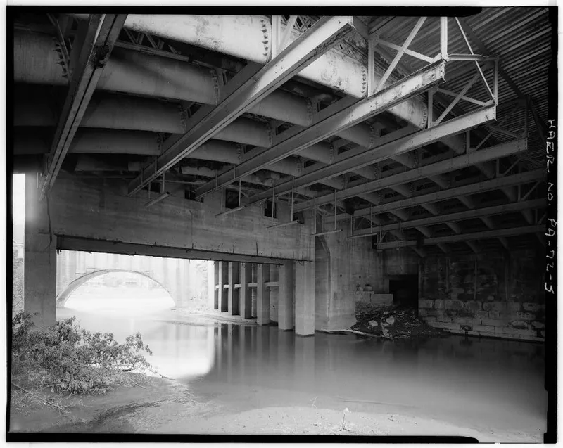
Spanning Dunlap's Creek on the National Road at Brownsville, Pennsylvania, this single-span bridge was built between 1836 and 1839 from designs prepared under Captain Richard Delafield. It has an 80-foot cast iron arch built from hollow curved ribs, with sandstone abutments and wrought iron railings. Earlier crossings at the site were a wooden bridge destroyed by flood in 1808, a chain-suspended bridge that collapsed in 1820, and a timber bridge. Delafield chose iron because local stone could not resist the outward thrust of an arch of this span, and wood was vulnerable to decay and fire. Its iron was tested in 1921 and found to have deteriorated very little. Concrete decking and I-beam supports were added later, but the original arch remains largely unchanged. The bridge was completed in 1839 and was the final Congressionally funded work on the Cumberland Road east of the Ohio.
Significance in brief: The nomination argues the bridge is significant as a farsighted engineering solution to the arch thrust problem that stone abutments could not resist, and as an early durable use of cast and wrought iron. Its iron was tested in 1921 and found to have deteriorated very little. It was also the last work on the Cumberland Road east of the Ohio River funded by Congress.
Machine-generated summary. This summary was generated by a language model from the official nomination document and has not been reviewed line by line by an editor. It may contain errors. Check the source document before relying on any detail. Source: nomination document (PDF) · National Archives catalog entry. NRHP reference 78002398, listed July 31, 1978. Summary generated October 2026 (model claude-haiku-5-5, prompt v1.1-2026-10-29, confidence medium).
Key facts
| Address | Spans Dunlap, Brownsville |
|---|---|
| County | Fayette County |
| Listed | July 31, 1978 |
| Reference number | 78002398 |
| Resource type | Structure |
| Period of significance | 1836-1839 |
| Architect / builder | Richard Delafield (architect) |
| Areas of significance | Engineering, Transportation, Invention |
| Level of significance | National |
| Acreage | 0.1 |
| Within district | Brownsville Commercial Historic District |
| Coordinates | 40.02135, -79.88829 (NPS GIS) |
What listing means for this property
For a publicly owned building or structure, listing mainly matters when federal funds, permits or licences are involved: projects then go through Section 106 review so effects on the property are considered. Listing also strengthens applications for preservation grants and, for leased income-producing uses, can enable the federal rehabilitation tax credit.
General information, not legal or tax advice. Rules change; confirm with your State Historic Preservation Office or a qualified adviser.
Sources and further reading
- National Park Service, National Register of Historic Places database (snapshot May 2026), reference 78002398.
- Nomination form (PDF, National Archives) — catalog entry
- Wikipedia article (used for cross-checking only; text not reproduced here)
- Wikidata Q5315401
- This listing as JSON
Last updated October 2026. Found an error? See the editorial policy for how to report it.