Brownsville Commercial Historic District
Also known as: See Also: Dunlap's Creek Bridge

Why it's listed
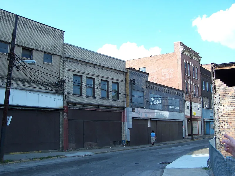
Brownsville's commercial district runs along Market, High and New Market streets on filled ground between the Monongahela River and the hillside, on the east bank in Fayette County. Its origins lie in the National Road, completed through the town in 1817, and in the causeway built across Dunlap's Creek to reach a bridge. The Flatiron Building dates from circa 1835, and a cast iron bridge over Dunlap's Creek, erected in 1839, is cited as the nation's first. Most of the district's buildings were erected between 1900 and 1930, when coal from the Klondike fields and the Monongahela Railway brought growth. Notable works include the Monongahela National Bank building of 1902, the Plaza Theater of 1920 and Union Station of 1928. The nomination regards the district as holding the finest concentration of early 20th-century commercial architecture in Fayette County.
Significance in brief: The nomination argues the district is significant in commerce, transportation and architecture. Its riverfront and National Road history, its role as a commercial center for the Klondike coal fields and the Monongahela Railway, and its concentration of early 20th-century commercial architecture in Fayette County are cited as the basis for listing.
Machine-generated summary. This summary was generated by a language model from the official nomination document and has not been reviewed line by line by an editor. It may contain errors. Check the source document before relying on any detail. Source: nomination document (PDF) · National Archives catalog entry. NRHP reference 93000716, listed August 2, 1993. Summary generated October 2026 (model claude-haiku-5-5, prompt v1.1-2026-10-29, confidence medium).
Key facts
| Address | 105--128 Brownsville Ave. and 1--145 Market, 101--200 High, 2--6 Water, 100 Charles, 1 Seneca and 108 Bank Sts., Brownsville |
|---|---|
| County | Fayette County |
| Listed | August 2, 1993 |
| Reference number | 93000716 |
| Resource type | District |
| Period of significance | 1835-1942 |
| Architectural style | Italianate, Classical Revival, Neoclassical, Art Deco, Art Moderne; most buildings described as vernacular |
| Criteria |
|
| Areas of significance | Commerce, Transportation, Architecture |
| Level of significance | Local |
| Status (as stated in the nomination) | Many buildings remain in place, though some were razed and some are deteriorated; several buildings were recently purchased for rehabilitation. |
| Acreage | 19 |
| Within district | Brownsville Northside Historic District |
| Coordinates | 40.02265, -79.88441 (NPS GIS) |
What listing means for this property
This is a historic district. Buildings within its boundary are either contributing (they add to the district's significance) or non-contributing. Owners of contributing income-producing buildings can claim the 20% federal rehabilitation tax credit; homeowners should look at state credits. National Register districts impose no design review by themselves; a local historic district ordinance, if one exists, does (the difference explained).
General information, not legal or tax advice. Rules change; confirm with your State Historic Preservation Office or a qualified adviser.
Sources and further reading
- National Park Service, National Register of Historic Places database (snapshot May 2026), reference 93000716.
- Nomination form (PDF, National Archives) — catalog entry
- Wikipedia article (used for cross-checking only; text not reproduced here)
- Wikidata Q15205195
- This listing as JSON
Last updated October 2026. Found an error? See the editorial policy for how to report it.