Fort Laurens Site
Also known as: Fort Laurens Site State Memorial

Why it's listed
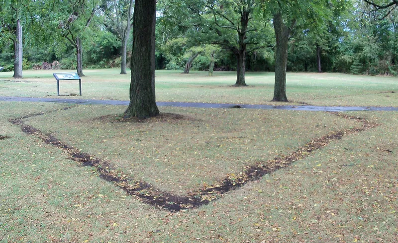
Fort Laurens Site, about half a mile south of Bolivar, Ohio, marks where an American frontier fort stood during the Revolutionary War. Troops under Gen. Lachlan McIntosh began building it in November 1778, naming it for Henry Laurens, president of the Continental Congress. It was meant to protect friendly Delawares and to launch an American campaign against Wyandot towns near Sandusky. The log fort, roughly 130 feet square, held a garrison of about 200 men and had a two-story blockhouse as its main defence. Supply lines were cut, and the garrison was besieged for about a month before relief arrived. The fort was evacuated in August 1779 because its position was judged impractical. Nothing is visible above ground today. A marker commemorates the site, and a 1971 test survey located part of the stockade wall and a bastion. The state memorial honours the men who built and defended the only U.S. fort on Ohio soil during the Revolution.
Significance in brief: The fort was built as part of a chain of blockhouses from Fort Pitt toward the British stronghold at Detroit. It was meant to protect friendly Delawares and to serve as a starting point for a campaign against hostile Wyandot towns. It is described as the only U.S. fort on Ohio soil during the Revolutionary War.
Machine-generated summary. This summary was generated by a language model from the official nomination document and has not been reviewed line by line by an editor. It may contain errors. Check the source document before relying on any detail. Source: nomination document (PDF) · National Archives catalog entry. NRHP reference 70000518, listed November 10, 1970. Summary generated October 2026 (model claude-sonnet-5-5, prompt v1.0-2026-10-29, confidence high).
Key facts
| Address | Near OH 212, 0.5 mi. S of Bolivar, Bolivar |
|---|---|
| County | Tuscarawas County |
| Listed | November 10, 1970 |
| Reference number | 70000518 |
| Resource type | Site |
| Period of significance | 1778 |
| Areas of significance | Military |
| Level of significance | State |
| Status (as stated in the nomination) | Ruins; no visible traces of the fort remain above ground. A historic marker stands on the site, and a small museum pavilion was planned. A test archaeological survey in spring 1971 tentatively located part of the stockade wall and southwest bastion. |
| Acreage | 20 |
| Coordinates | 40.63904, -81.45584 (NPS GIS) |
What listing means for this property
Sites (archaeological sites, battlefields, landscapes) are often listed with a restricted address to protect them from looting or disturbance. Listing is honorary for private owners; federal undertakings on or near the site go through Section 106 review, and state laws may protect burials and artefacts regardless of listing.
General information, not legal or tax advice. Rules change; confirm with your State Historic Preservation Office or a qualified adviser.
Sources and further reading
- National Park Service, National Register of Historic Places database (snapshot May 2026), reference 70000518.
- Nomination form (PDF, National Archives) — catalog entry
- Wikipedia article (used for cross-checking only; text not reproduced here)
- Wikidata Q5471486
- This listing as JSON
Last updated October 2026. Found an error? See the editorial policy for how to report it.