Horseshoe Mound
Also known as: Portsmouth Group

Why it's listed
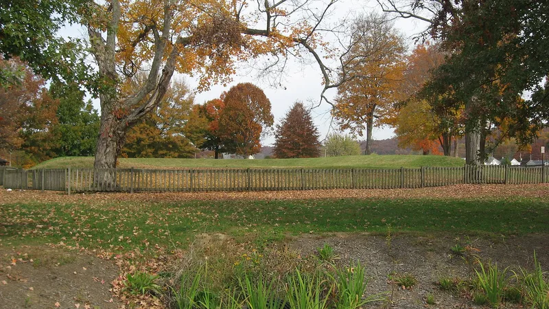
Horseshoe Mound is a U-shaped earthen embankment in Mound Park, off Hutchins Avenue in Portsmouth, Ohio. The embankment is 30 to 33 feet wide at the base and 7.5 feet high, enclosing an interior 75 feet across and 178 feet long. It has probably been reconstructed and is well maintained by the city. The mound is the only surviving Ohio piece of the Portsmouth Group, a large prehistoric complex near the meeting of the Scioto and Ohio rivers. The group once included two horseshoe-shaped embankments, circles, crescents, mounds and parallel walls stretching about eight miles, linked to two large geometric works in Kentucky. It was probably built over a long period and used as a ceremonial center during the Hopewell Phase, 400 B.C. to A.D. 700. Several rises elsewhere in the park may mark other mounds shown on an 1848 map, so the whole park, about 8.25 acres, was included to help preserve what remains.
Significance in brief: It is all that remains in Ohio of the Portsmouth Group, described as one of the most impressive prehistoric works in the Ohio Valley. The complex was probably a ceremonial center used during the Hopewell Phase. The whole park was nominated because rises within it may be bases of other mounds shown on the 1848 Squier and Davis map.
Machine-generated summary. This summary was generated by a language model from the official nomination document and has not been reviewed line by line by an editor. It may contain errors. Check the source document before relying on any detail. Source: nomination document (PDF) · National Archives catalog entry. NRHP reference 74001621, listed May 2, 1974. Summary generated October 2026 (model claude-sonnet-5-5, prompt v1.0-2026-10-29, confidence high).
Key facts
| Address | Within Mound Park, Portsmouth |
|---|---|
| County | Scioto County |
| Listed | May 2, 1974 |
| Reference number | 74001621 |
| Resource type | Site |
| Period of significance | 400 B.C. to A.D. 700 |
| Areas of significance | Prehistoric |
| Level of significance | State |
| Status (as stated in the nomination) | Described as in excellent condition and well maintained in a municipal park; probably reconstructed. The form checks the status as unoccupied and the present use as park. |
| Acreage | 8.3 |
| Coordinates | 38.74329, -82.97700 (NPS GIS) |
What listing means for this property
Sites (archaeological sites, battlefields, landscapes) are often listed with a restricted address to protect them from looting or disturbance. Listing is honorary for private owners; federal undertakings on or near the site go through Section 106 review, and state laws may protect burials and artefacts regardless of listing.
General information, not legal or tax advice. Rules change; confirm with your State Historic Preservation Office or a qualified adviser.
Sources and further reading
- National Park Service, National Register of Historic Places database (snapshot May 2026), reference 74001621.
- Nomination form (PDF, National Archives) — catalog entry
- Wikidata Q116268128
- This listing as JSON
Last updated October 2026. Found an error? See the editorial policy for how to report it.