Fallen Timbers Battlefield

Why it's listed
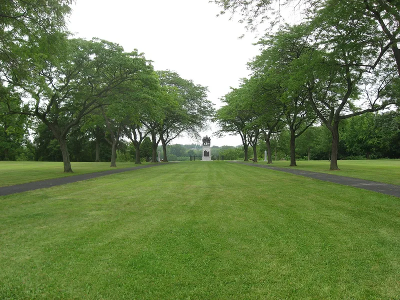
Nine acres of high ground above the Maumee River valley in Maumee, Ohio, mark the site of the Battle of Fallen Timbers, fought on August 20, 1794. The state-owned memorial park holds three monuments: a 1929 statue of General Anthony Wayne flanked by a Native American and an American soldier, sculpted by Bruce Wilder Saville; Turkey Rock, linked by legend to Chief Turkey Foot; and a plaque listing the men of Wayne's army. The actual fighting covered a far larger area, and the surrounding land is still mostly farm fields. The battle matters because Wayne's victory over the Indian confederation, together with the British refusal to shelter the defeated warriors, weakened resistance to American expansion. It led to the 1795 Treaty of Green Ville and opened the way for rapid settlement of the Northwest Territory. The park is fenced and dedicated to recognizing the battle.
Significance in brief: The nomination presents the August 20, 1794 victory of General Anthony Wayne over the Indian confederation as the culminating event in the struggle for the Old Northwest. The victory asserted American sovereignty in the west and led to the 1795 Treaty of Green Ville. It opened a period of peaceful settlement of the Ohio Country.
Machine-generated summary. This summary was generated by a language model from the official nomination document and has not been reviewed line by line by an editor. It may contain errors. Check the source document before relying on any detail. Source: nomination document (PDF) · National Archives catalog entry. NRHP reference 66000616, listed October 15, 1966. Summary generated October 2026 (model claude-sonnet-5-5, prompt v1.0-2026-10-29, confidence medium).
Key facts
| Address | 2 mi. W of Maumee on U.S. 24, Maumee |
|---|---|
| County | Lucas County |
| Listed | October 15, 1966 |
| Reference number | 66000616 |
| Resource type | Site |
| Period of significance | 1794 |
| Architect / builder | Bruce Wilder Saville (sculptor of the 1929 monument) |
| Areas of significance | Military |
| Level of significance | National |
| National Historic Landmark | Yes, designated October 9, 1960 |
| Status (as stated in the nomination) | State-owned memorial park, occupied and open to the public without restriction; interpretive material is very limited, and the surrounding landscape remains largely agricultural. |
| Acreage | 9 |
| Coordinates | 41.54423, -83.69739 (NPS GIS) |
What listing means for this property
Sites (archaeological sites, battlefields, landscapes) are often listed with a restricted address to protect them from looting or disturbance. Listing is honorary for private owners; federal undertakings on or near the site go through Section 106 review, and state laws may protect burials and artefacts regardless of listing.
General information, not legal or tax advice. Rules change; confirm with your State Historic Preservation Office or a qualified adviser.
Sources and further reading
- National Park Service, National Register of Historic Places database (snapshot May 2026), reference 66000616.
- Nomination form (PDF, National Archives) — catalog entry
- Wikipedia article (used for cross-checking only; text not reproduced here)
- Wikidata Q5432259
- This listing as JSON
Last updated October 2026. Found an error? See the editorial policy for how to report it.