Newark Earthworks
Also known as: Mound Builders State Memorial; Octagon State Memorial; Wright

Why it's listed
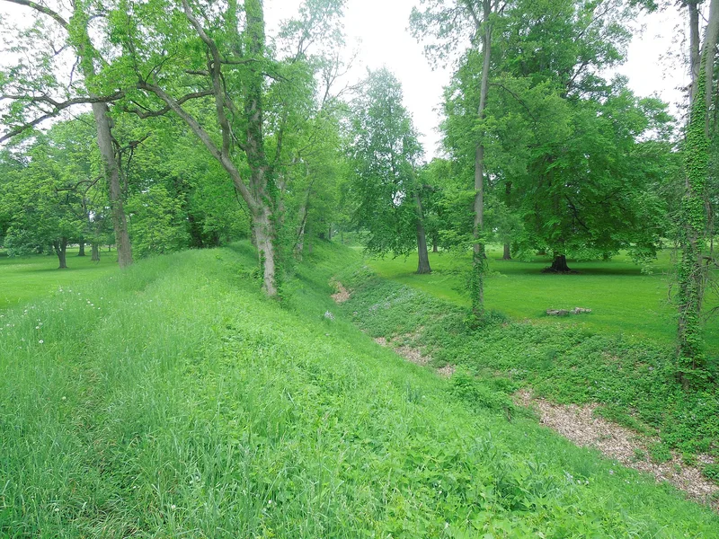
Three surviving fragments of a once enormous Hopewell earthwork complex lie in Newark, Ohio. In 1848 the complex covered over two square miles, with circles, an octagon and a square joined by long parallel walls, plus many mounds. City growth destroyed much of it, but the Octagon section (120 acres), the Mound Builders section (66 acres) and the small Wright Earthworks remain under state protection. The Octagon enclosure holds 50 acres and joins a 20-acre circle by parallel walls. The Mound Builders circle, about 1,200 feet across, has walls 8 to 14 feet high, an interior ditch and a central eagle-shaped mound. The works date from roughly 300 B.C. to 250 A.D. and show the planning and labor of the Hopewell, whose trade networks and burial traditions are described in the form. Professional excavation has been limited, though the earthworks and artifacts are known to be typically Hopewell. The Octagon section is used as a golf course.
Significance in brief: The works are some of the best remaining evidence of large-scale geometric construction by the Hopewell Indians, in the focal area of Hopewell culture. Originally covering about 2 square miles, the remnants show the planning and effort behind a huge building program. The earthworks are typical of Hopewell ceremonial, social and religious centers.
Machine-generated summary. This summary was generated by a language model from the official nomination document and has not been reviewed line by line by an editor. It may contain errors. Check the source document before relying on any detail. Source: nomination document (PDF) · National Archives catalog entry. NRHP reference 66000614, listed October 15, 1966. Summary generated October 2026 (model claude-sonnet-5-5, prompt v1.0-2026-10-29, confidence high).
Key facts
| Address | Roughly bounded by Union, 30th, James, and Waldo Sts., and OH 16, Newark |
|---|---|
| County | Licking County |
| Listed | October 15, 1966 |
| Reference number | 66000614 |
| Resource type | Site |
| Period of significance | approximately 300 B.C. - 250 A.D. |
| Architect / builder | Hopewell Indians (builders) |
| Areas of significance | Prehistoric |
| Level of significance | National |
| National Historic Landmark | Yes, designated July 19, 1964 |
| Status (as stated in the nomination) | Three sections are preserved by the State of Ohio as memorial parks; the Octagon section operates as a golf course. The condition is marked good, and the form notes that modern park buildings are intrusions. |
| Acreage | 190 |
| Coordinates | 40.05447, -82.44417 (NPS GIS) |
What listing means for this property
Sites (archaeological sites, battlefields, landscapes) are often listed with a restricted address to protect them from looting or disturbance. Listing is honorary for private owners; federal undertakings on or near the site go through Section 106 review, and state laws may protect burials and artefacts regardless of listing.
General information, not legal or tax advice. Rules change; confirm with your State Historic Preservation Office or a qualified adviser.
Sources and further reading
- National Park Service, National Register of Historic Places database (snapshot May 2026), reference 66000614.
- Nomination form (PDF, National Archives) — catalog entry
- Wikipedia article (used for cross-checking only; text not reproduced here)
- Wikidata Q7016678
- This listing as JSON
Last updated October 2026. Found an error? See the editorial policy for how to report it.