Village Historic District
Also known as: See Also:Wyoming Presbyterian Church
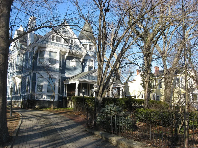

Why it's listed
The Village Historic District is a residential and civic neighborhood in Wyoming, Hamilton County, Ohio, listed in 1986 as part of a multiple resource nomination for the community. Its boundary follows whole lot lines and runs along streets including Springfield Pike, Wentworth Avenue, Burns Avenue, Grove Avenue, Oak Avenue, Water Street, Van Roberts Street and East Mills Avenue. Maps of the area show churches, a library, schools, a civic center and parks among the houses. A federal reviewer described the district as a good illustration of the development of a late 19th and early 20th century commuter suburb and recommended its acceptance under criteria A, B and C. The nomination was accepted and entered in the National Register in August 1986. The text supplied here contains mainly boundary descriptions, maps and review sheets, so details of individual buildings, architects and styles are not available.
Significance in brief: The reviewer's comments describe the district as documenting the development and significance of a late 19th/early 20th century commuter suburb. The reviewer recommended acceptance under criteria A, B and C. The full description and significance statement are in the multiple resource area form, which is not included here.
Machine-generated summary. This summary was generated by a language model from the official nomination document and has not been reviewed line by line by an editor. It may contain errors. Check the source document before relying on any detail. Source: nomination document (PDF) · National Archives catalog entry. NRHP reference 86001626, listed August 25, 1986. Summary generated October 2026 (model claude-sonnet-5-5, prompt v1.0-2026-10-29, confidence low).
Key facts
| Address | Roughly bounded by Wentworth Ave., B & O RR tracks, E. Mill Ave., and Springfield Pike, Wyoming |
|---|---|
| County | Hamilton County |
| Listed | August 25, 1986 |
| Reference number | 86001626 |
| Resource type | District |
| Criteria |
|
| Areas of significance | Industry, Community Planning and Development, Architecture |
| Level of significance | Local |
| Acreage | 178 |
| Coordinates | 39.22407, -84.46947 (NPS GIS) |
What listing means for this property
This is a historic district. Buildings within its boundary are either contributing (they add to the district's significance) or non-contributing. Owners of contributing income-producing buildings can claim the 20% federal rehabilitation tax credit; homeowners should look at state credits. National Register districts impose no design review by themselves; a local historic district ordinance, if one exists, does (the difference explained).
General information, not legal or tax advice. Rules change; confirm with your State Historic Preservation Office or a qualified adviser.
Sources and further reading
- National Park Service, National Register of Historic Places database (snapshot May 2026), reference 86001626.
- Nomination form (PDF, National Archives) — catalog entry
- Wikipedia article (used for cross-checking only; text not reproduced here)
- Wikidata Q7930655
- This listing as JSON
Last updated October 2026. Found an error? See the editorial policy for how to report it.