Union Baptist Cemetery (Additional Documentation)

Why it's listed
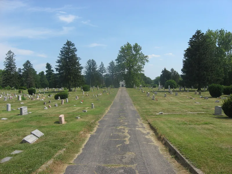
Union Baptist Cemetery is a 16-acre burial ground on a hilltop in Cincinnati's Price Hill neighborhood, about five miles west of downtown. The Union Baptist Church bought the land in 1865, though a plaque at the entrance gives 1864 as the founding year. The grounds have aged fir trees, a chain link fence, a central drive and two yellow brick gateposts with bronze plaques. A concrete block office building from 1951 sits in an oval drive near the center. It has arched brick hoodmolds and an octagonal belfry, so it resembles a rural chapel. The church grew from fourteen Black and mixed-race members who left the white Enon Baptist Church in 1831, and the cemetery serves as its burial ground. Interments include pastors, the Fossett family, Civil War veterans such as Sgt. Powhatan Beaty, and the relocated 1838 sandstone marker of Rev. David Nickens. The site is significant for its links to social history and African American heritage in Cincinnati.
Significance in brief: The cemetery is tied to the history of Cincinnati's African American community and its oldest Black Baptist congregation, which formed in 1831. It holds the graves of church leaders, Civil War veterans and other prominent Black Cincinnatians, including Rev. David Nickens, whose 1838 sandstone marker is an important early artifact. The nomination cites social history and ethnic heritage as its areas of significance.
Machine-generated summary. This summary was generated by a language model from the official nomination document and has not been reviewed line by line by an editor. It may contain errors. Check the source document before relying on any detail. Source: nomination document (PDF) · National Archives catalog entry. NRHP reference 02001057, listed September 20, 2002. Summary generated October 2026 (model claude-sonnet-5-5, prompt v1.0-2026-10-29, confidence medium).
Key facts
| Address | 4933 Cleves Warsaw Pike, Cincinnati |
|---|---|
| County | Hamilton County |
| Listed | September 20, 2002 |
| Reference number | 02001057 |
| Resource type | District |
| Period of significance | 1864-1952 |
| Areas of significance | Ethnic Heritage-Black, Social History |
| Level of significance | Local |
| Status (as stated in the nomination) | Well-kept, still used as a cemetery; it keeps its original 16 acres and shape. The 1951 office building is in use for offices, bathrooms and storage. |
| Acreage | 16 |
| Coordinates | 39.11671, -84.60261 (NPS GIS) |
What listing means for this property
This is a historic district. Buildings within its boundary are either contributing (they add to the district's significance) or non-contributing. Owners of contributing income-producing buildings can claim the 20% federal rehabilitation tax credit; homeowners should look at state credits. National Register districts impose no design review by themselves; a local historic district ordinance, if one exists, does (the difference explained).
General information, not legal or tax advice. Rules change; confirm with your State Historic Preservation Office or a qualified adviser.
Sources and further reading
- National Park Service, National Register of Historic Places database (snapshot May 2026), reference 02001057.
- Nomination form (PDF, National Archives) — catalog entry
- Wikipedia article (used for cross-checking only; text not reproduced here)
- Wikidata Q7885404
- This listing as JSON
Last updated October 2026. Found an error? See the editorial policy for how to report it.