Gilbert Town Historic District
Also known as: Archaeological Site No. 31RF128

Why it's listed
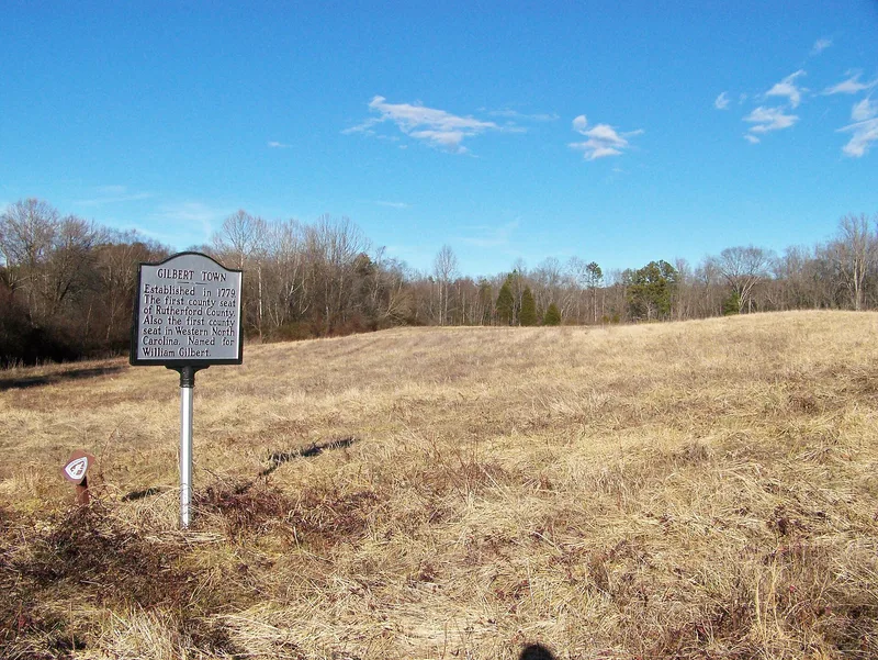
Gilbert Town is a historic district of about 459.5 acres northeast of Rutherfordton, North Carolina, now mostly farmland and woodland along Cathey's Creek. William Gilbert acquired land here from 1772 and ran a public house, store and blacksmith shop that made the settlement a stopping point on the frontier road to upland South Carolina. Gilbert held county and assembly offices and was buried in the Gilbert Cemetery in 1790. From 1781 to 1783 his house served as the Rutherford County courthouse. During the Revolutionary War the settlement was used by Patriot and Loyalist forces, and in September 1780 Major Patrick Ferguson camped there with about 1,000 troops before the Overmountain Men gathered against him. Gilbert Town was then used to hold prisoners and to care for wounded Patriot soldiers. A 2004 archaeological survey recovered musket balls, sword fragments and eighteenth-century nails and pottery from eight loci, although no eighteenth-century buildings remain standing.
Significance in brief: The nomination argues the district is significant under criterion A for its role in Revolutionary War campaigns between 1776 and 1782, when Gilbert Town served as a staging ground, campsite, prison and hospital, including Major Patrick Ferguson's occupation in September 1780 before the King's Mountain campaign. It is also significant under criterion B for its association with William Gilbert, a prominent settler and politician, and contains his grave, which is counted under criteria consideration C.
Machine-generated summary. This summary was generated by a language model from the official nomination document and has not been reviewed line by line by an editor. It may contain errors. Check the source document before relying on any detail. Source: nomination document (PDF) · National Archives catalog entry. NRHP reference 06000726, listed August 23, 2006. Summary generated October 2026 (model claude-haiku-5-5, prompt v1.1-2026-10-29, confidence medium).
Key facts
| Address | Along sections of Rock Rd.-NC 1520 and Old Gilbert Town Rd.-NC 1539, Rutherfordton |
|---|---|
| County | Rutherford County |
| Listed | August 23, 2006 |
| Reference number | 06000726 |
| Resource type | District |
| Period of significance | 1776-1782 |
| Criteria |
|
| Areas of significance | Military, Politics/Government, Historic - Non-Aboriginal |
| Level of significance | State |
| Status (as stated in the nomination) | Cultivated fields and woodland; contains one contributing archaeological site with eight loci, a contributing landscape, and thirty-six non-contributing buildings, three non-contributing structures and one non-contributing object. |
| Acreage | 459.5 |
| Coordinates | 35.40634, -81.94330 (NPS GIS) |
What listing means for this property
This is a historic district. Buildings within its boundary are either contributing (they add to the district's significance) or non-contributing. Owners of contributing income-producing buildings can claim the 20% federal rehabilitation tax credit; homeowners should look at state credits. National Register districts impose no design review by themselves; a local historic district ordinance, if one exists, does (the difference explained).
General information, not legal or tax advice. Rules change; confirm with your State Historic Preservation Office or a qualified adviser.
Sources and further reading
- National Park Service, National Register of Historic Places database (snapshot May 2026), reference 06000726.
- Nomination form (PDF, National Archives) — catalog entry
- Wikipedia article (used for cross-checking only; text not reproduced here)
- Wikidata Q19866554
- This listing as JSON
Last updated October 2026. Found an error? See the editorial policy for how to report it.