Bennett Place State Historic Site

Why it's listed
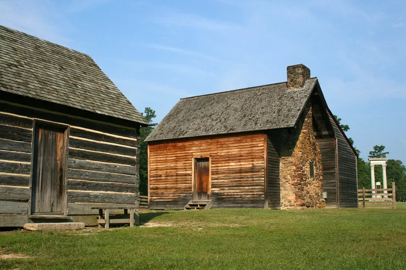
Bennett Place is a small farm complex of about 30.5 acres near Durham, North Carolina, consisting of a reconstructed one-story log farmhouse, a log kitchen and a smokehouse. James Bennett, a cobbler, distiller, blacksmith and farmer, bought the land in 1846. In April 1865, after Lee's surrender at Appomattox, Generals Joseph E. Johnston and William T. Sherman met to negotiate terms. Johnston suggested the farmhouse he had passed on the road, so the Bennett home was chosen by chance. Talks lasted until April 18, and a final settlement was signed April 26, covering more than 89,000 Confederate troops. The house burned in 1921. The family of Samuel T. Morgan bought the site and gave it to the state, which dedicated it in 1923. A 1958 gift funded reconstruction, using materials from the nearby 1804 Billy Proctor house and the original stone chimney. The site is listed for its role in ending the war in the southeast.
Significance in brief: The farmhouse was the setting for the surrender of General Joseph E. Johnston to General William T. Sherman in April 1865, which effectively ended the Civil War in the southeast. The surrender covered more than 89,000 Confederate troops, a larger force than the one surrendered at Appomattox. The nomination also notes the farm is typical of mid-nineteenth-century Piedmont farmsteads.
Machine-generated summary. This summary was generated by a language model from the official nomination document and has not been reviewed line by line by an editor. It may contain errors. Check the source document before relying on any detail. Source: nomination document (PDF) · National Archives catalog entry. NRHP reference 70000452, listed February 26, 1970. Summary generated October 2026 (model claude-sonnet-5-5, prompt v1.0-2026-10-29, confidence high).
Key facts
| Address | Jct. of SR 1313 and 1314, Durham |
|---|---|
| County | Durham County |
| Listed | February 26, 1970 |
| Reference number | 70000452 |
| Resource type | Site |
| Period of significance | 19th Century; specific date 1865 surrender |
| Areas of significance | Military, Politics/Government, Architecture |
| Level of significance | National |
| Status (as stated in the nomination) | Condition marked excellent and altered, on its original site. The original house burned in 1921 and was reconstructed using period materials and the original chimney. The site is state-owned and open as a park and museum. |
| Acreage | 30.5 |
| Coordinates | 36.02930, -78.97529 (NPS GIS) |
What listing means for this property
Sites (archaeological sites, battlefields, landscapes) are often listed with a restricted address to protect them from looting or disturbance. Listing is honorary for private owners; federal undertakings on or near the site go through Section 106 review, and state laws may protect burials and artefacts regardless of listing.
General information, not legal or tax advice. Rules change; confirm with your State Historic Preservation Office or a qualified adviser.
Sources and further reading
- National Park Service, National Register of Historic Places database (snapshot May 2026), reference 70000452.
- Nomination form (PDF, National Archives) — catalog entry
- Wikipedia article (used for cross-checking only; text not reproduced here)
- Wikidata Q2896339
- This listing as JSON
Last updated October 2026. Found an error? See the editorial policy for how to report it.