New Bern National Cemetery

Why it's listed
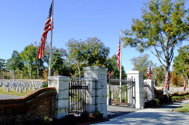
New Bern National Cemetery occupies nearly eight flat, tree-shaded acres in a residential part of New Bern, North Carolina. Established in 1867, it is enclosed by a brick wall built in 1874, with wrought-iron gates added in 1939. By mid-1996 it held more than 6,500 graves used for casketed remains and over 160 sites for cremated remains. Contributing features include the 1916 lodge, the perimeter wall and gate, an octagonal iron, brick and shell-stone rostrum used for memorial ceremonies, a flagpole, and monuments erected by Connecticut, Rhode Island, Massachusetts and New Jersey between 1905 and 1908. The cemetery is significant for its association with the Civil War. New Bern served as a major Union outpost and fortified garrison, occupied from 1862 to 1865 after the Battle of New Bern. The cemetery forms part of a group of Civil War era national cemeteries.
Significance in brief: The nomination argues it is significant under Criterion A for its association with the Civil War. New Bern was a major Union outpost and garrison occupied from 1862 to 1865, and the cemetery is part of the Civil War Era National Cemeteries group.
Machine-generated summary. This summary was generated by a language model from the official nomination document and has not been reviewed line by line by an editor. It may contain errors. Check the source document before relying on any detail. Source: nomination document (PDF) · National Archives catalog entry. NRHP reference 97000023, listed January 31, 1997. Summary generated October 2026 (model claude-sonnet-5-5, prompt v1.0-2026-10-29, confidence medium).
Key facts
| Address | 1711 National Ave., New Bern |
|---|---|
| County | Craven County |
| Listed | January 31, 1997 |
| Reference number | 97000023 |
| Resource type | Site |
| Period of significance | 1867-1932 |
| Architectural style | Bungalow/Craftsman |
| Criteria |
|
| Areas of significance | Military |
| Level of significance | National |
| Status (as stated in the nomination) | Closed to new burials in 1992 except in occupied and reserved graves; interments in those graves continue. As of June 30, 1996, 70 gravesites remained available. |
| Acreage | 7.7 |
| Coordinates | 35.12375, -77.05294 (NPS GIS) |
What listing means for this property
Sites (archaeological sites, battlefields, landscapes) are often listed with a restricted address to protect them from looting or disturbance. Listing is honorary for private owners; federal undertakings on or near the site go through Section 106 review, and state laws may protect burials and artefacts regardless of listing.
General information, not legal or tax advice. Rules change; confirm with your State Historic Preservation Office or a qualified adviser.
Sources and further reading
- National Park Service, National Register of Historic Places database (snapshot May 2026), reference 97000023.
- Nomination form (PDF, National Archives) — catalog entry
- Wikipedia article (used for cross-checking only; text not reproduced here)
- Wikidata Q7005515
- This listing as JSON
Last updated October 2026. Found an error? See the editorial policy for how to report it.