Cape Lookout Light Station

Why it's listed
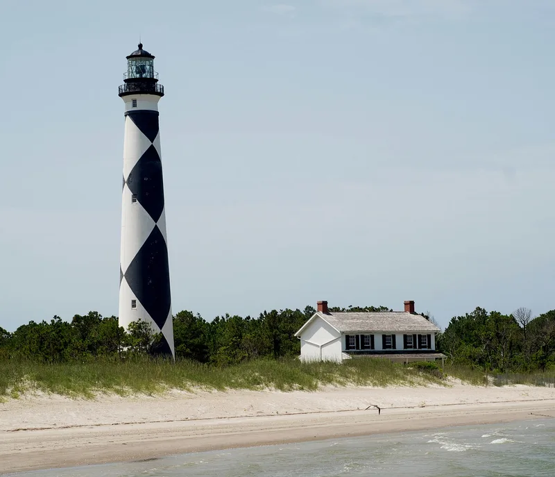
Cape Lookout Light Station occupies the sandy expanse of Core Banks, North Carolina, facing Barden Inlet and the Atlantic. The complex includes a 169-foot conical brick lighthouse painted in a black and white diamond pattern, a brick keeper's dwelling from 1873, a generator house, a coal and wood shed, and a small cement block oil house. The tower was built between 1857 and 1859 to replace an earlier lighthouse threatened by drifting sand, and its light began operating in November 1859. Confederate troops damaged the tower and ruined the lens during the Civil War, but the light was working again by 1863. An iron spiral stair replaced the original wooden one in 1867. The lighthouse became the prototype for later Outer Banks lighthouses, and it warns ships of shoals extending about ten miles seaward. Sand mounds nearby are said to mark the first lighthouse.
Significance in brief: The 1857-1859 lighthouse became the prototype for all lighthouses later erected on the Outer Banks. It is one of two North Carolina lighthouses built before the Civil War, and its beam and checkered pattern have long served as a warning and landmark for mariners near the dangerous Core Banks shoals.
Machine-generated summary. This summary was generated by a language model from the official nomination document and has not been reviewed line by line by an editor. It may contain errors. Check the source document before relying on any detail. Source: nomination document (PDF) · National Archives catalog entry. NRHP reference 72000097, listed October 18, 1972. Summary generated October 2026 (model claude-sonnet-5-5, prompt v1.0-2026-10-29, confidence medium).
Key facts
| Address | On Core Banks, Core Banks |
|---|---|
| County | Carteret County |
| Listed | October 18, 1972 |
| Reference number | 72000097 |
| Resource type | Structure |
| Period of significance | 19th Century (lighthouse 1857-1859; keeper's quarters 1873) |
| Areas of significance | Transportation, Communications |
| Level of significance | State |
| Status (as stated in the nomination) | Listed in good condition, altered, on its original site; the form marks the property as occupied and in government and private residence use. Later letters describe it as endangered by erosion. |
| Acreage | 25 |
| Within district | Cape Lookout Village Historic District |
| Coordinates | 34.62338, -76.52462 (NPS GIS) |
What listing means for this property
For a publicly owned building or structure, listing mainly matters when federal funds, permits or licences are involved: projects then go through Section 106 review so effects on the property are considered. Listing also strengthens applications for preservation grants and, for leased income-producing uses, can enable the federal rehabilitation tax credit.
General information, not legal or tax advice. Rules change; confirm with your State Historic Preservation Office or a qualified adviser.
Sources and further reading
- National Park Service, National Register of Historic Places database (snapshot May 2026), reference 72000097.
- Nomination form (PDF, National Archives) — catalog entry
- Wikipedia article (used for cross-checking only; text not reproduced here)
- Wikidata Q4286379
- This listing as JSON
Last updated October 2026. Found an error? See the editorial policy for how to report it.