Cape Lookout Coast Guard Station

Why it's listed
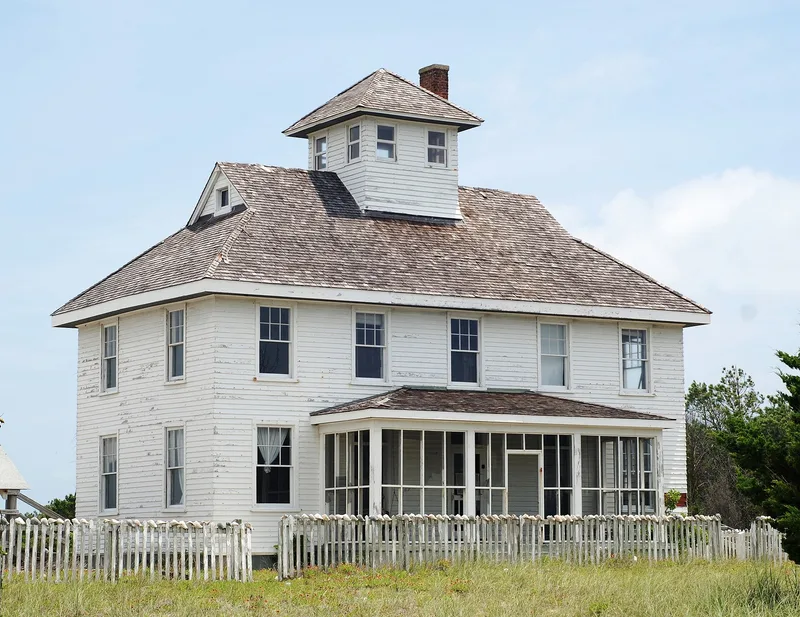
Built on Core Banks between 1916 and 1917, the Main Station is a two-story, 44-foot-by-25-foot building with a central watchtower from which crews scanned the waters for ships in distress. It housed office space and living quarters for a crew of nine, and it sits on the highest ground in a district that also includes a galley, a cistern, and a 1940 equipment building with four large vehicle doors. The station was sited near Cape Lookout Shoals, which lay directly in coastal shipping lanes and made the area one of the most hazardous on the North Carolina coast. Its Main Station is the last of three buildings built from the same plans and the only surviving station of its design in the state. A 24-hour watch was kept from the tower until search and rescue operations ended in 1982. Many local crew members came from nearby communities such as Harkers Island and Beaufort.
Significance in brief: The station is regarded as significant for its role in protecting coastal shipping near Cape Lookout Shoals, one of the most dangerous areas on the North Carolina coast. Its Main Station is the last known of three buildings built from the same plans and the only surviving station of that design in the state. The nomination also cites its association with early USCG history, its relatively unaltered buildings, and its role during World War II.
Machine-generated summary. This summary was generated by a language model from the official nomination document and has not been reviewed line by line by an editor. It may contain errors. Check the source document before relying on any detail. Source: nomination document (PDF) · National Archives catalog entry. NRHP reference 88003436, listed February 1, 1989. Summary generated October 2026 (model claude-haiku-5-5, prompt v1.1-2026-10-29, confidence high).
Key facts
| Address | Cape Lookout, Beaufort |
|---|---|
| County | Carteret County |
| Listed | February 1, 1989 |
| Reference number | 88003436 |
| Resource type | District |
| Period of significance | 1917-1982 |
| Architectural style | Austere interpretation of the Neo-Colonial mode of Georgian Revival (Main Station); vernacular (Galley); Southern type of Colonial Architecture (Equipment Building) |
| Criteria |
|
| Areas of significance | Commerce, Military, Transportation |
| Level of significance | State |
| Status (as stated in the nomination) | Decommissioned on 10 June 1982; search and rescue operations ceased 15 May 1982. |
| Acreage | 5.4 |
| Coordinates | 34.60330, -76.53773 (NPS GIS) |
What listing means for this property
This is a historic district. Buildings within its boundary are either contributing (they add to the district's significance) or non-contributing. Owners of contributing income-producing buildings can claim the 20% federal rehabilitation tax credit; homeowners should look at state credits. National Register districts impose no design review by themselves; a local historic district ordinance, if one exists, does (the difference explained).
Noted as vacant in the nomination. Nomination documents can be decades old; current status may differ. If you are considering buying an empty listed property, read the due-diligence checklist.
General information, not legal or tax advice. Rules change; confirm with your State Historic Preservation Office or a qualified adviser.
Sources and further reading
- National Park Service, National Register of Historic Places database (snapshot May 2026), reference 88003436.
- Nomination form (PDF, National Archives) — catalog entry
- Wikipedia article (used for cross-checking only; text not reproduced here)
- Wikidata Q15207396
- This listing as JSON
Last updated October 2026. Found an error? See the editorial policy for how to report it.