Dula-Horton Cemetery

Why it's listed
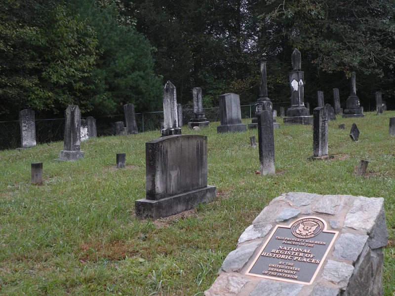
Dula-Horton Cemetery is a one-acre family burying ground on Dula Hill, a hilltop overlooking the Yadkin River bottomlands in eastern Caldwell County. It holds sixty-eight graves of members of the Dula, Horton and Jones families, laid out in five rows, mostly marked by white marble tablets, with a group of obelisks dating from the 1880s to 1910s. The earliest burial is that of Captain William Dula in 1835. Dula acquired about 1,800 acres along the Yadkin between 1791 and 1804 and became one of the wealthiest men in the Happy Valley. The family house on the hill burned in 1949, leaving the cemetery as the main surviving reminder of his family's five generations there. The cemetery is also a well-preserved example of the plantation family burial grounds common before church graveyards became widespread. The period of significance runs from 1835 to 1947, and descendants still maintain the site.
Significance in brief: It is the sole surviving resource tied to Captain William Dula and his role in settling the upper Yadkin River valley, since the family house burned in 1949. It is also a well-preserved example of the private plantation family burial grounds of the North Carolina frontier, from before church cemeteries became common.
Machine-generated summary. This summary was generated by a language model from the official nomination document and has not been reviewed line by line by an editor. It may contain errors. Check the source document before relying on any detail. Source: nomination document (PDF) · National Archives catalog entry. NRHP reference 04000941, listed September 2, 2004. Summary generated October 2026 (model claude-sonnet-5-5, prompt v1.0-2026-10-29, confidence high).
Key facts
| Address | End of an 0.25 mile Ln, off S side of NC 268, 1.4 mi. E of jct. with Grandin Rd., Grandin |
|---|---|
| County | Caldwell County |
| Listed | September 2, 2004 |
| Reference number | 04000941 |
| Resource type | Site |
| Period of significance | 1835-1947 |
| Criteria |
|
| Areas of significance | Social History, Exploration/Settlement |
| Level of significance | Local |
| Status (as stated in the nomination) | Still maintained as a family cemetery, enclosed by a woven wire fence erected around 1990; the last burial took place in 1989. |
| Acreage | 1 |
| Coordinates | 36.06263, -81.41532 (NPS GIS) |
What listing means for this property
Sites (archaeological sites, battlefields, landscapes) are often listed with a restricted address to protect them from looting or disturbance. Listing is honorary for private owners; federal undertakings on or near the site go through Section 106 review, and state laws may protect burials and artefacts regardless of listing.
General information, not legal or tax advice. Rules change; confirm with your State Historic Preservation Office or a qualified adviser.
Sources and further reading
- National Park Service, National Register of Historic Places database (snapshot May 2026), reference 04000941.
- Nomination form (PDF, National Archives) — catalog entry
- Wikipedia article (used for cross-checking only; text not reproduced here)
- Wikidata Q18148369
- This listing as JSON
Last updated October 2026. Found an error? See the editorial policy for how to report it.