Crooked Lake Outlet Historic District

Why it's listed
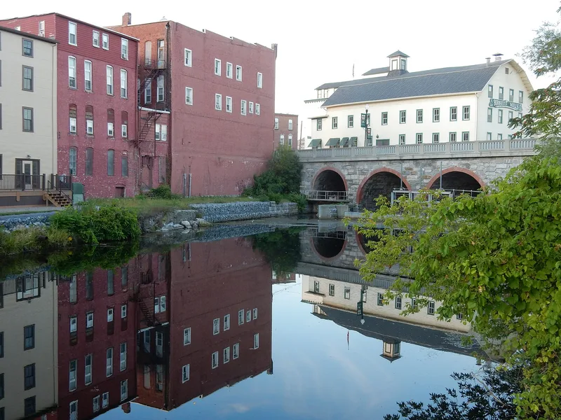
Along a seven-mile gorge between Penn Yan and Dresden, the Keuka Lake Outlet drops from Keuka Lake toward Seneca Lake, and for nearly two centuries its water drove industry. The historic district follows this corridor and includes mill sites, mill ponds, races, dams, canal locks, the canal prism, bridges, a railroad turntable, whistle stops and mile markers. At its busiest, as many as forty mills used the Outlet, producing flour, lumber, textiles, spokes and paper. The Crooked Lake Canal, begun in 1831, was meant to carry goods but never made money and closed in 1878. The Fall Brook Railroad, begun in 1884 on the old towpath, ran until it was abandoned in 1974. The Main Street Bridge, a multiple-arch stone bridge of 1884, marks the western edge. Birkett's Mill still grinds buckwheat flour. Because much of the gorge is undeveloped, the district preserves extensive archaeological remains, and the old towpath and rail bed now serve as a public trail.
Significance in brief: The district records almost two hundred years of milling technology powered by the Outlet, together with the Crooked Lake Canal and the Fall Brook Railroad that served the mills. It holds standing remains and extensive undisturbed archaeological deposits, such as at Hopeton, Fox's Mill and May's Mill. The form presents it as a research opportunity not available elsewhere in western New York.
Machine-generated summary. This summary was generated by a language model from the official nomination document and has not been reviewed line by line by an editor. It may contain errors. Check the source document before relying on any detail. Source: nomination document (PDF) · National Archives catalog entry. NRHP reference 95001545, listed January 19, 1996. Summary generated October 2026 (model claude-sonnet-5-5, prompt v1.0-2026-10-29, confidence medium).
Key facts
| Address | Along the Keuka Lake Outlet Trail, from Penn Yan to Dresden, Penn Yan |
|---|---|
| County | Yates County |
| Listed | January 19, 1996 |
| Reference number | 95001545 |
| Resource type | District |
| Architect / builder | Main Street Bridge built by Ira Lunt (1884); other mills built by figures such as Abraham Wagener, David Wagener and Samuel Lawrence |
| Areas of significance | Transportation, Architecture, Industry, Engineering, Historic - Aboriginal |
| Level of significance | Local |
| Status (as stated in the nomination) | Most mill sites are in decay or reduced to foundations; Birkett's Mill remains in use, the Yates County Malthouse is abandoned, and the canal towpath and rail bed are now a hiking trail. |
| Acreage | 300 |
| Coordinates | 42.67700, -76.96335 (NPS GIS) |
What listing means for this property
This is a historic district. Buildings within its boundary are either contributing (they add to the district's significance) or non-contributing. Owners of contributing income-producing buildings can claim the 20% federal rehabilitation tax credit; homeowners should look at state credits. National Register districts impose no design review by themselves; a local historic district ordinance, if one exists, does (the difference explained).
General information, not legal or tax advice. Rules change; confirm with your State Historic Preservation Office or a qualified adviser.
Sources and further reading
- National Park Service, National Register of Historic Places database (snapshot May 2026), reference 95001545.
- Nomination form (PDF, National Archives) — catalog entry
- Wikipedia article (used for cross-checking only; text not reproduced here)
- Wikidata Q5187830
- This listing as JSON
Last updated October 2026. Found an error? See the editorial policy for how to report it.