Croton Aqueduct, Old
Also known as: See Also:Old Croton Dam, Site of; High Bridges Aqueduct; Water
Why it's listed
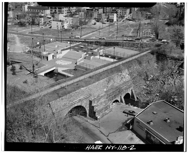
Running twenty-six miles through Westchester County, the Old Croton Aqueduct carried water from Croton Lake to New York City beginning in 1842. Built between 1837 and 1842 under chief engineer John B. Jervis, it was the city's first major water supply project, answering a long crisis of contaminated wells, fire risk and disease. Most of the line is underground, constructed of brick and stone with a concrete foundation. Surface clues include twenty-two ventilator shafts about fourteen feet tall, stone gatehouses, seven viaducts and six culverts. The aqueduct surpassed earlier European aqueducts in cross-section and used a siphon on a scale not seen before. Demand outgrew it by 1875, and newer aqueducts followed. Water flowed through it to the city until 1955, and some communities drew from it for ten more years. The gates were closed in 1965, and the State of New York took title in 1968. A recreational trailway is planned along the right-of-way.
Significance in brief: It was the first major water supply system for New York City and a notable engineering achievement of its day. It was one of the first aqueducts to reach beyond a city for water, and its cross-section and use of the siphon exceeded earlier aqueducts. It supplied the city's water from 1842 until it went out of use in 1965.
Machine-generated summary. This summary was generated by a language model from the official nomination document and has not been reviewed line by line by an editor. It may contain errors. Check the source document before relying on any detail. Source: nomination document (PDF) · National Archives catalog entry. NRHP reference 74001324, listed December 2, 1974. Summary generated October 2026 (model claude-sonnet-5-5, prompt v1.0-2026-10-29, confidence medium).
Key facts
| Address | Runs N from Yonkers to New Croton Dam, Yonkers and |
|---|---|
| County | Westchester County |
| Listed | December 2, 1974 |
| Reference number | 74001324 |
| Resource type | Structure |
| Period of significance | 1837-1842 |
| Architect / builder | John B. Jervis, chief engineer |
| Areas of significance | Commerce, Health/Medicine, Engineering |
| Level of significance | National, Local |
| National Historic Landmark | Yes, designated April 27, 1992 |
| Status (as stated in the nomination) | Out of use since 1965; State of New York took title in 1968; about 85% of the Westchester length is sound and 15% has minor structural defects; a trailway is being planned along the right-of-way. |
| Acreage | 168 |
| Within district | Irvington Historic District |
| Coordinates | 41.03998, -73.86664 (NPS GIS) |
What listing means for this property
National Register listing is honorary: it recognises significance and does not restrict what a private owner may do without federal money or permits. It unlocks the 20% federal rehabilitation tax credit for income-producing buildings, state credits in many states, and Section 106 review when federal agencies are involved. See what listing means in practice.
General information, not legal or tax advice. Rules change; confirm with your State Historic Preservation Office or a qualified adviser.
Sources and further reading
- National Park Service, National Register of Historic Places database (snapshot May 2026), reference 74001324.
- Nomination form (PDF, National Archives) — catalog entry
- Wikipedia article (used for cross-checking only; text not reproduced here)
- Wikidata Q1141610
- This listing as JSON
Last updated October 2026. Found an error? See the editorial policy for how to report it.