Lake George Battlefield Park Historic District

Why it's listed
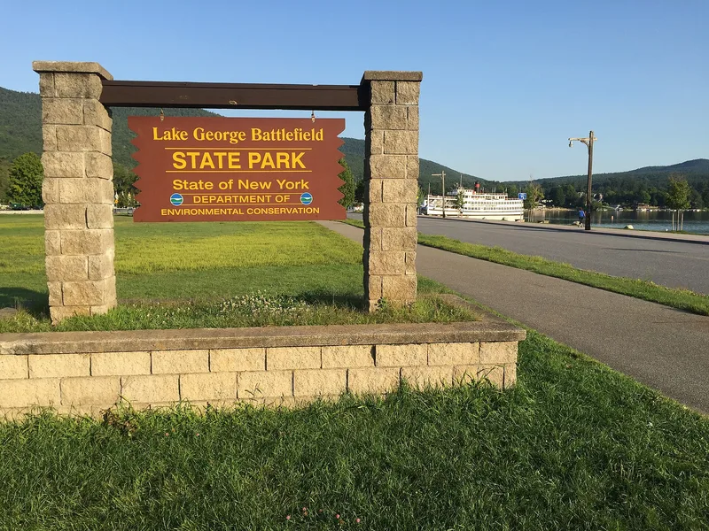
Lake George Battlefield Park Historic District covers 118 acres at the southern tip of Lake George, in Warren County, New York. New York State bought and developed the land between 1896 and 1965 to protect sites linked to the region's early military history and to give the public a place to recreate. The district includes the earthen and stone bastion of Fort George from 1759, surviving entrenchments from 1757 and 1758, foundations of barracks and a hospital, hut sites, a lime or brick kiln, and a submerged 1758 dock. Excavations in 2000 and 2001 recovered British ceramics, musket parts and regimental buttons, some tied to the Revolutionary War. The park also holds statues, plaques, markers and two mid-nineteenth-century farm buildings adapted for park use. Today it operates as public land with a beach, campground, picnic grounds and trails. The district contains 39 contributing resources.
Significance in brief: The district preserves archaeological remains of mid-eighteenth-century British military occupations, including the 1759 Fort George bastion, 1757-58 entrenchments, barracks and hospital foundations, and a 1758 dock, along with sites tied to the Revolutionary War era. It also holds monuments and markers, and records an early state effort to protect historic battlefields and provide public recreation. The form certifies significance at the statewide level.
Machine-generated summary. This summary was generated by a language model from the official nomination document and has not been reviewed line by line by an editor. It may contain errors. Check the source document before relying on any detail. Source: nomination document (PDF) · National Archives catalog entry. NRHP reference 11000971, listed December 30, 2011. Summary generated October 2026 (model claude-sonnet-5-5, prompt v1.0-2026-10-29, confidence medium).
Key facts
| Address | 139 Beach Rd., Lake George |
|---|---|
| County | Warren County |
| Listed | December 30, 2011 |
| Reference number | 11000971 |
| Resource type | District |
| Architect / builder | James Montresor, British military engineer, involved in the design and construction of the Fort George bastion |
| Areas of significance | Historic - Aboriginal, Military, Social History, Entertainment/Recreation |
| Level of significance | State |
| Status (as stated in the nomination) | Maintained as public recreation land with a beach, boat launch, campground, picnic grounds, hiking trails, bike paths and parking areas. |
| Acreage | 118 |
| Coordinates | 43.41925, -73.70496 (NPS GIS) |
What listing means for this property
This is a historic district. Buildings within its boundary are either contributing (they add to the district's significance) or non-contributing. Owners of contributing income-producing buildings can claim the 20% federal rehabilitation tax credit; homeowners should look at state credits. National Register districts impose no design review by themselves; a local historic district ordinance, if one exists, does (the difference explained).
General information, not legal or tax advice. Rules change; confirm with your State Historic Preservation Office or a qualified adviser.
Sources and further reading
- National Park Service, National Register of Historic Places database (snapshot May 2026), reference 11000971.
- Nomination form (PDF, National Archives) — catalog entry
- Wikipedia article (used for cross-checking only; text not reproduced here)
- Wikidata Q23091848
- This listing as JSON
Last updated October 2026. Found an error? See the editorial policy for how to report it.