Glens Falls Feeder Canal

Why it's listed
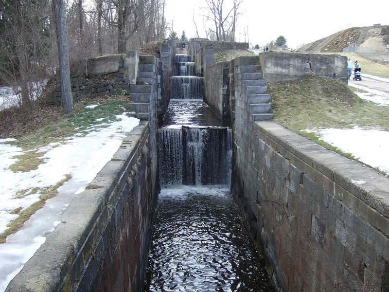
This seven-mile canal runs just north of the Hudson River, starting at a feeder dam in Queensbury and passing through Glens Falls, Kingsbury and Hudson Falls to meet the Champlain Canal at Fort Edward. Built between 1824 and 1829 to supply water to the Champlain Canal, it was opened to boat traffic in 1832 after thirteen locks were added to handle a 130-foot drop. The wooden locks were later rebuilt in local Kingsbury bluestone and enlarged, and concrete bypass sluices were added in 1912-1915. Mules pulled boats along the south-bank towpath. The canal carried lumber, bluestone, marble, lime and paper to Albany and New York City, helping make Glens Falls a leading lumber-producing center; in 1853 alone 37 million board feet were shipped. Rail eventually replaced it, and the last commercial cargo, newsprint, moved in October 1928. The canal still feeds water to the Champlain Barge Canal, and its locks and towpath largely survive.
Significance in brief: The nomination argues the canal was a transportation and engineering feature that drove the economic development of Glens Falls and the upper Hudson-Southern Adirondack region. It carried lumber, bluestone, marble, lime and paper to Albany and New York City through the nineteenth century. The canal, towpath and all thirteen locks remain substantially intact, showing the route as it was during the region's industrial boom.
Machine-generated summary. This summary was generated by a language model from the official nomination document and has not been reviewed line by line by an editor. It may contain errors. Check the source document before relying on any detail. Source: nomination document (PDF) · National Archives catalog entry. NRHP reference 85003401, listed October 25, 1985. Summary generated October 2026 (model claude-sonnet-5-5, prompt v1.0-2026-10-29, confidence medium).
Key facts
| Address | Roughly between Richardson St. and the Old Champlain Canal, Glens Falls |
|---|---|
| County | Warren County |
| Listed | October 25, 1985 |
| Reference number | 85003401 |
| Resource type | Structure |
| Architect / builder | Resident engineer James Walker supervised completion; route surveyed by Canvass White; first proposed by James Geddes |
| Criteria |
|
| Areas of significance | Engineering, Transportation |
| Level of significance | Local |
| Status (as stated in the nomination) | Commercial navigation ended in 1928; the canal still supplies water to the Champlain Barge Canal and is nominally maintained by the New York State Department of Transportation. |
| Acreage | 43.8 |
| Coordinates | 43.30073, -73.61117 (NPS GIS) |
What listing means for this property
National Register listing is honorary: it recognises significance and does not restrict what a private owner may do without federal money or permits. It unlocks the 20% federal rehabilitation tax credit for income-producing buildings, state credits in many states, and Section 106 review when federal agencies are involved. See what listing means in practice.
General information, not legal or tax advice. Rules change; confirm with your State Historic Preservation Office or a qualified adviser.
Sources and further reading
- National Park Service, National Register of Historic Places database (snapshot May 2026), reference 85003401.
- Nomination form (PDF, National Archives) — catalog entry
- Wikipedia article (used for cross-checking only; text not reproduced here)
- Wikidata Q5569310
- This listing as JSON
Last updated October 2026. Found an error? See the editorial policy for how to report it.