Old Albany Post Road

Why it's listed
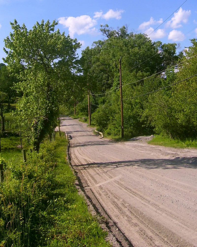
This 6.6-mile stretch of dirt road in Philipstown, Putnam County, is part of the Old Albany Post Road, the original land route between New York City and Albany. It runs along a ridge east of the Hudson River, following older Native American paths, and is lined with stone walls and mature trees. A postal route was established here in 1669, and the British widened it in 1754 to move troops and supplies. It also served as a supply route during the Revolutionary War. Sandstone milestones set in 1797-98 survive, numbered 52 through 58 except 56, and some are sheltered in stone or brick. When the Highland Turnpike bypassed the road in 1806, later modernization went elsewhere, leaving this section narrow, unpaved and rural. Apart from a paved mile near Travis Corners, it keeps its eighteenth-century route and dimensions, which is why it is considered the least altered surviving part of the original 150-mile Post Road.
Significance in brief: The road was the original land route between New York City and Albany, improved through the 17th and 18th centuries for mail, goods and troops. After the Highland Turnpike bypassed it in 1806, this section kept its 18th-century route, width, stone walls and milestones. It is described as the least altered surviving section of the 150-mile Post Road.
Machine-generated summary. This summary was generated by a language model from the official nomination document and has not been reviewed line by line by an editor. It may contain errors. Check the source document before relying on any detail. Source: nomination document (PDF) · National Archives catalog entry. NRHP reference 82003396, listed July 8, 1982. Summary generated October 2026 (model claude-sonnet-5-5, prompt v1.0-2026-10-29, confidence medium).
Key facts
| Address | US 9, Philipstown |
|---|---|
| County | Putnam County |
| Listed | July 8, 1982 |
| Reference number | 82003396 |
| Resource type | Structure |
| Period of significance | 1600-1899 |
| Architect / builder | unknown |
| Areas of significance | Transportation |
| Level of significance | State |
| Status (as stated in the nomination) | Still a narrow, unpaved, rural road owned by the Town of Philipstown and in public use; about one mile near Travis Corners has recently been paved with tar and gravel. Six of seven original milestones remain. |
| Acreage | 40 |
| Coordinates | 41.34083, -73.90397 (NPS GIS) |
What listing means for this property
National Register listing is honorary: it recognises significance and does not restrict what a private owner may do without federal money or permits. It unlocks the 20% federal rehabilitation tax credit for income-producing buildings, state credits in many states, and Section 106 review when federal agencies are involved. See what listing means in practice.
General information, not legal or tax advice. Rules change; confirm with your State Historic Preservation Office or a qualified adviser.
Sources and further reading
- National Park Service, National Register of Historic Places database (snapshot May 2026), reference 82003396.
- Nomination form (PDF, National Archives) — catalog entry
- Wikipedia article (used for cross-checking only; text not reproduced here)
- Wikidata Q7083375
- This listing as JSON
Last updated October 2026. Found an error? See the editorial policy for how to report it.