Dock Hill Road Extension Stone Arch Bridge
Also known as: Upper Dock Hill Road Bridge

Why it's listed
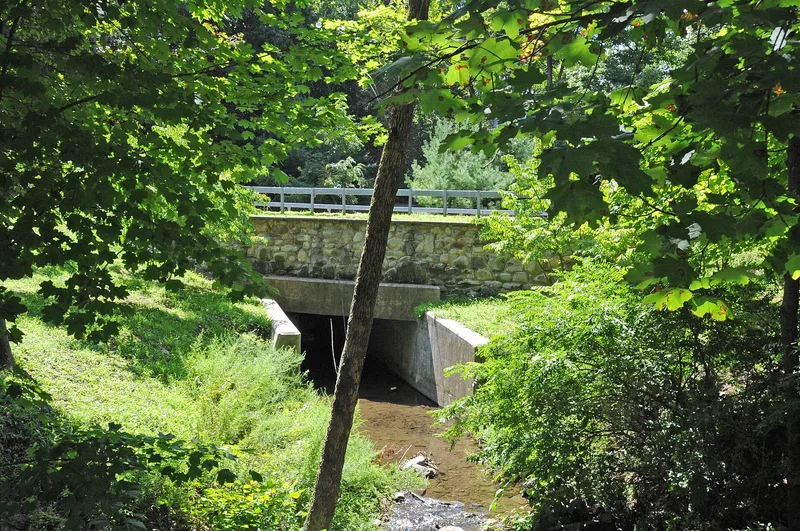
This small stone arch bridge on Dock Hill Road Extension in Cornwall-on-Hudson, New York, once carried Bay View Avenue over a creek running down from the hills to the west. It is a single elliptical arch of locally quarried stone set in mortar. Finely dressed, hand-tooled ashlar voussoirs form the arch, while the spandrels and low parapet walls are of rougher stone, topped with rectangular copings. No construction records were found, so a date of about 1870 is assigned from comparison with other Hudson Valley stone arch bridges. The builder is unknown. The bridge dates from a period when tourism helped the village grow. It was bypassed when Bay View Avenue was rerouted, after Storm King Highway was completed in the early 1920s, and a Civilian Conservation Corps concrete arch bridge was built just to the west in the 1930s. It is regarded as the most intact 19th-century stone arch bridge in the village and still serves limited traffic and pedestrians.
Significance in brief: The bridge is described as the most intact example of 19th-century stone arch bridge construction in the village, with its bearing arch, spandrel and parapet walls, copings and buttresses largely original. It is significant for architecture as a small-scale example of a bridge type that preceded standardized metal truss bridges, and for transportation as evidence of the village's road improvements in the later 19th century.
Machine-generated summary. This summary was generated by a language model from the official nomination document and has not been reviewed line by line by an editor. It may contain errors. Check the source document before relying on any detail. Source: nomination document (PDF) · National Archives catalog entry. NRHP reference 09001230, listed January 13, 2010. Summary generated October 2026 (model claude-sonnet-5-5, prompt v1.0-2026-10-29, confidence high).
Key facts
| Address | Dock Hill Rd. Extension, Cornwall-on-Hudson |
|---|---|
| County | Orange County |
| Listed | January 13, 2010 |
| Reference number | 09001230 |
| Resource type | Structure |
| Period of significance | c. 1870-c. 1935 |
| Architect / builder | Unknown |
| Criteria |
|
| Areas of significance | Architecture, Transportation |
| Level of significance | Local |
| Status (as stated in the nomination) | Currently carries limited vehicular and pedestrian use and is in a relatively good state of repair; paved with asphalt. |
| Acreage | 0.9 |
| Coordinates | 41.44497, -74.00665 (NPS GIS) |
What listing means for this property
For a publicly owned building or structure, listing mainly matters when federal funds, permits or licences are involved: projects then go through Section 106 review so effects on the property are considered. Listing also strengthens applications for preservation grants and, for leased income-producing uses, can enable the federal rehabilitation tax credit.
General information, not legal or tax advice. Rules change; confirm with your State Historic Preservation Office or a qualified adviser.
Sources and further reading
- National Park Service, National Register of Historic Places database (snapshot May 2026), reference 09001230.
- Nomination form (PDF, National Archives) — catalog entry
- Wikipedia article (used for cross-checking only; text not reproduced here)
- Wikidata Q5287196
- This listing as JSON
Last updated October 2026. Found an error? See the editorial policy for how to report it.