Elmwood Park

Why it's listed
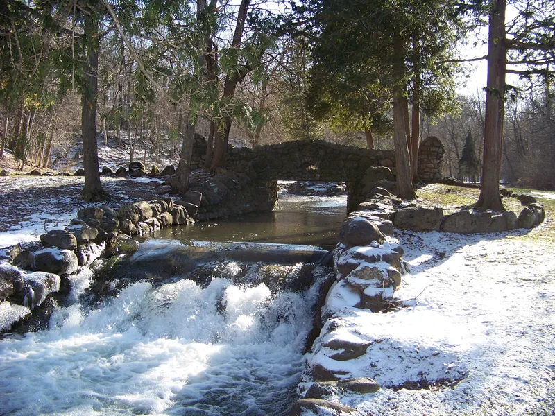
Elmwood Park is a linear public park in Syracuse, New York, running east to west along Furnace Brook in a steep, wooded valley. The listed portion covers 26.5 acres of a larger 67.5-acre park and includes an 1830s stone mill the city bought in 2000. The site began with a mill and iron foundry, then became a series of private resort pleasure grounds between about 1890 and 1920, with later plans and fires ending that use. The city bought the land in 1927. During the Great Depression, Works Progress Administration crews built rustic stone stairs, walls, bridges, edging and weirs that remain largely intact. The park has six distinct spaces: entrance, east glade, recreation area, island space, west glade and upper plateau. It is recognized as an intact park showing Pleasure Ground and Reform Park Era design, with forty-one contributing historic features including the road and path system.
Significance in brief: The nomination argues the park is an intact example of a Pleasure Ground Period and Reform Park Era park. Its pleasure ground landscape combines with rustic stonework built by New Deal work relief crews, giving it a unique place in local park history. It is nominated as part of the multiple property group Historic Designed Landscapes of Syracuse, New York.
Machine-generated summary. This summary was generated by a language model from the official nomination document and has not been reviewed line by line by an editor. It may contain errors. Check the source document before relying on any detail. Source: nomination document (PDF) · National Archives catalog entry. NRHP reference 05000439, listed May 19, 2005. Summary generated October 2026 (model claude-sonnet-5-5, prompt v1.0-2026-10-29, confidence medium).
Key facts
| Address | Glenwood Ave., South Ave., City Boundary, Syracuse |
|---|---|
| County | Onondaga County |
| Listed | May 19, 2005 |
| Reference number | 05000439 |
| Resource type | Site |
| Architect / builder | Works Progress Administration work relief crews (rustic stairs, walls, bridges and embankments) |
| Architectural style | Pleasure Ground Era Park with New Deal Era features overlay; Other: Rustic |
| Criteria |
|
| Areas of significance | Landscape Architecture, Community Planning and Development, Entertainment/Recreation |
| Level of significance | Local |
| Status (as stated in the nomination) | Used as a public park and outdoor recreation area; the 1830s mill adjacent to the park was bought by the city in 2000 for parkland. |
| Acreage | 26.5 |
| Coordinates | 43.01708, -76.16843 (NPS GIS) |
What listing means for this property
Sites (archaeological sites, battlefields, landscapes) are often listed with a restricted address to protect them from looting or disturbance. Listing is honorary for private owners; federal undertakings on or near the site go through Section 106 review, and state laws may protect burials and artefacts regardless of listing.
General information, not legal or tax advice. Rules change; confirm with your State Historic Preservation Office or a qualified adviser.
Sources and further reading
- National Park Service, National Register of Historic Places database (snapshot May 2026), reference 05000439.
- Nomination form (PDF, National Archives) — catalog entry
- Wikipedia article (used for cross-checking only; text not reproduced here)
- Wikidata Q5366985
- This listing as JSON
Last updated October 2026. Found an error? See the editorial policy for how to report it.