Dyckman Street Subway Station (IRT)

Why it's listed
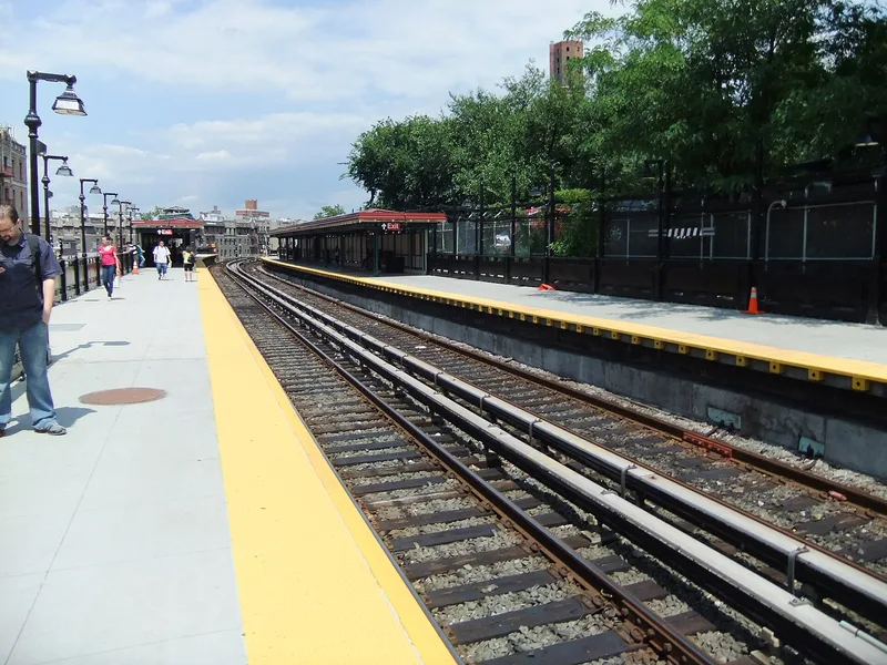
Dyckman Street Station is an elevated subway stop in Washington Heights, Manhattan, opened in 1906 as part of the original Interborough Rapid Transit system. It sits on a triangular island between Hillside and St. Nicholas Avenues, where the line emerges from the Fort George Tunnel and meets grade. A wedge-shaped Beaux-Arts control house of concrete patterned to imitate ashlar stone supports the tracks and platforms above. Platforms carry trussed-steel canopies and cast-iron railings typical of early IRT elevated stations. The tunnel portal, also by Heins & LaFarge, has a rusticated granite arch and the inscription "Fort George 1776-1906." The station is significant for its role in transportation and in the growth of upper Manhattan and the Bronx. It is also valued as a unique Beaux-Arts design among mostly similar elevated stations, engineered by William Barclay Parsons. The control house interior was renovated in 1990-1991, though much original fabric remains.
Significance in brief: The station is significant for transportation, community planning and development, and social history as one of the original IRT elevated stations. It is also significant for engineering and architecture as a unique Beaux-Arts station and control house by Heins & LaFarge, built into a hillside beside the Fort George Tunnel. It retains a relatively high degree of integrity.
Machine-generated summary. This summary was generated by a language model from the official nomination document and has not been reviewed line by line by an editor. It may contain errors. Check the source document before relying on any detail. Source: nomination document (PDF) · National Archives catalog entry. NRHP reference 04001021, listed September 17, 2004. Summary generated October 2026 (model claude-sonnet-5-5, prompt v1.0-2026-10-29, confidence high).
Key facts
| Address | Bet. Hillside and St. Nicholas Aves. , jct. of Dyckman St. and Nagle Ave., New York |
|---|---|
| County | Manhattan |
| Listed | September 17, 2004 |
| Reference number | 04001021 |
| Resource type | Structure |
| Period of significance | 1906-1908 |
| Architect / builder | Parsons, William Barclay (engineer); Heins, George L. and LaFarge, Christopher G. (architects) |
| Architectural style | Late 19th & 20th Century Revivals/Beaux-Arts |
| Criteria |
|
| Areas of significance | Transportation, Architecture, Art, Engineering, Community Planning and Development, Social History |
| Level of significance | National, Local |
| Status (as stated in the nomination) | Still in transportation use; the control house interior was extensively renovated in 1990-1991 and platform extensions were added in 1908. |
| Acreage | 0.9 |
| Within district | Dominican Historic District |
| Coordinates | 40.86083, -73.92556 (NPS GIS) |
What listing means for this property
For an income-producing building, listing (individually or as a contributing building in a district) is the gateway to the 20% federal rehabilitation tax credit on qualified rehabilitation costs, often stackable with state credits. Work claiming the credit must follow the Secretary of the Interior's Standards and be approved in advance.
Listing does not restrict a private owner acting without federal money or permits; where federal funding or licensing is involved, Section 106 review applies.
General information, not legal or tax advice. Rules change; confirm with your State Historic Preservation Office or a qualified adviser.
Sources and further reading
- National Park Service, National Register of Historic Places database (snapshot May 2026), reference 04001021.
- Nomination form (PDF, National Archives) — catalog entry
- Wikipedia article (used for cross-checking only; text not reproduced here)
- Wikidata Q2051404
- This listing as JSON
Last updated October 2026. Found an error? See the editorial policy for how to report it.