Fort St. Frederic

Why it's listed
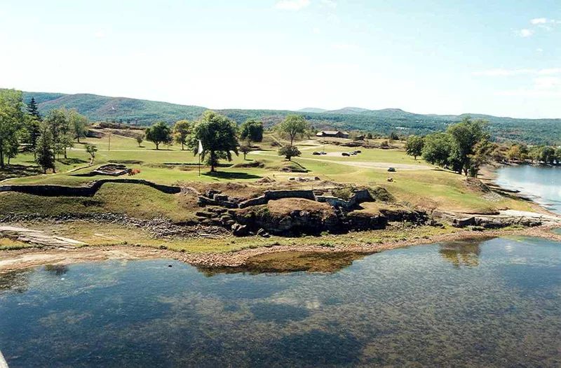
Fort St. Frederic occupies the Crown Point peninsula on Lake Champlain, where the lake narrows to roughly a quarter to half a mile. The French began building the stone fort in 1731 under the Sieur de la Fresniere. It was a pentagon-shaped starwork with bastions, ramparts about twenty feet high and thick, a stone-walled ditch and an octagonal slate watchtower. A small church, stone quarters and a fortified windmill lookout completed the works, and French farmers and traders settled along the nearby eastern shore. From this base the French blocked an invasion route into Canada and launched raids on English colonies. A British offensive in 1755 was turned back before reaching the fort. In 1759 the French garrison withdrew and blew up the magazine, and Amherst then built a larger fort nearby. Ruins of the fort were partly capped in masonry around 1910 and are now stabilized within a New York State park, alongside scattered remains of the French settlement.
Significance in brief: Control of Lake Champlain was a key objective in the eighteenth-century French and English struggle for North America. The fort blocked the lake as an invasion route into Canada and served as a base for raids on English settlements. It was abandoned and destroyed by the French in 1759 and was never rebuilt.
Machine-generated summary. This summary was generated by a language model from the official nomination document and has not been reviewed line by line by an editor. It may contain errors. Check the source document before relying on any detail. Source: nomination document (PDF) · National Archives catalog entry. NRHP reference 66000517, listed October 15, 1966. Summary generated October 2026 (model claude-sonnet-5-5, prompt v1.0-2026-10-29, confidence medium).
Key facts
| Address | Jct. of NY 8 and 9N, Crown Point |
|---|---|
| County | Essex County |
| Listed | October 15, 1966 |
| Reference number | 66000517 |
| Resource type | Site |
| Period of significance | 1731-1759 |
| Architect / builder | Sieur de la Fresniere (directed construction) |
| Architectural style | Starwork fort (a pentagon with bastions at the angles) |
| Areas of significance | Military, Exploration/Settlement |
| Level of significance | National |
| National Historic Landmark | Yes, designated October 9, 1960 |
| Status (as stated in the nomination) | Ruins partly capped with masonry around 1910 and stabilized by New York State; the fort site is maintained as a historic site within Crown Point Reservation, while nearby land is used as a camping and picnic ground. |
| Acreage | 300 |
| Coordinates | 44.00420, -73.41824 (NPS GIS) |
What listing means for this property
Sites (archaeological sites, battlefields, landscapes) are often listed with a restricted address to protect them from looting or disturbance. Listing is honorary for private owners; federal undertakings on or near the site go through Section 106 review, and state laws may protect burials and artefacts regardless of listing.
General information, not legal or tax advice. Rules change; confirm with your State Historic Preservation Office or a qualified adviser.
Sources and further reading
- National Park Service, National Register of Historic Places database (snapshot May 2026), reference 66000517.
- Nomination form (PDF, National Archives) — catalog entry
- Wikipedia article (used for cross-checking only; text not reproduced here)
- Wikidata Q3078036
- This listing as JSON
Last updated October 2026. Found an error? See the editorial policy for how to report it.