Rhinebeck Village Historic District (Boundary Increase)

Why it's listed
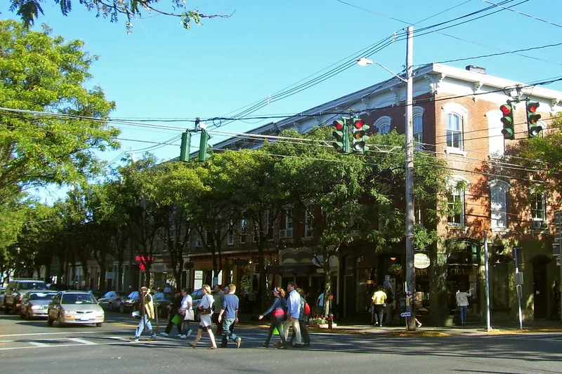
Rhinebeck's village center sits on a flat plain about a mile and a half east of the Hudson River. This district covers about 167 acres and some 340 buildings, a large share of the present village. Moderately scaled nineteenth-century houses, churches and shops line streets with large hardwood trees, bluestone sidewalks, hitching posts and period fences. A commercial core stands where Mill, Montgomery and Market Streets meet, surrounded by medium-density residential blocks. Styles range from Georgian and Federal to Greek Revival, Gothic Revival, Italianate, Second Empire and Colonial Revival. Notable buildings include the Delamater House, designed by A. J. Davis in 1844, and the Montgomery House, associated with General Richard Montgomery taking command of northern forces in 1775. Local builders such as Stephen McCarty and Ralph Decker shaped parts of the streetscape. The village's density and scale remain much as they were in the later nineteenth century, which is the main reason the area was recognized as a district.
Significance in brief: The nomination argues the district preserves the nineteenth-century density, scale and character of a Hudson Valley village, with a commercial core surrounded by residential streets. It shows a wide range of styles from Georgian to Colonial Revival, including work by A. J. Davis and local carpenter-builders. It also includes the Montgomery House, tied to the 1775 Revolutionary War command of General Richard Montgomery.
Machine-generated summary. This summary was generated by a language model from the official nomination document and has not been reviewed line by line by an editor. It may contain errors. Check the source document before relying on any detail. Source: nomination document (PDF) · National Archives catalog entry. NRHP reference 100006011, listed January 15, 2021. Summary generated October 2026 (model claude-sonnet-5-5, prompt v1.0-2026-10-29, confidence medium).
Key facts
| Address | Portions of Platt Ave., Mill, Oak, Mulberry, and North Parsonage Sts., Rhinebeck |
|---|---|
| County | Dutchess County |
| Listed | January 15, 2021 |
| Reference number | 100006011 |
| Resource type | District |
| Architect / builder | A. J. Davis (Delamater House, 1844); Stephen McCarty, local carpenter-builder (possibly); Ralph Decker (Bracketed cottages on East Market Street) |
| Architectural style | Georgian, Federal, Greek Revival, Gothic Revival, Bracketed, Italianate, Second Empire, Queen Anne, Colonial Revival, and Victorian Residential |
| Areas of significance | Community Planning and Development, Commerce, Transportation, Architecture, Ethnic Heritage-Black |
| Level of significance | Local |
| Status (as stated in the nomination) | The district is occupied. Some buildings have been modernized, mostly with modern siding, but the nineteenth-century character is largely preserved. |
| Acreage | 82.3 |
| Coordinates | 41.92667, -73.91250 (Wikidata) |
What listing means for this property
This is a historic district. Buildings within its boundary are either contributing (they add to the district's significance) or non-contributing. Owners of contributing income-producing buildings can claim the 20% federal rehabilitation tax credit; homeowners should look at state credits. National Register districts impose no design review by themselves; a local historic district ordinance, if one exists, does (the difference explained).
General information, not legal or tax advice. Rules change; confirm with your State Historic Preservation Office or a qualified adviser.
Sources and further reading
- National Park Service, National Register of Historic Places database (snapshot May 2026), reference 100006011.
- Nomination form (PDF, National Archives) — catalog entry
- Wikipedia article (used for cross-checking only; text not reproduced here)
- Wikidata Q7320557
- This listing as JSON
Last updated October 2026. Found an error? See the editorial policy for how to report it.