Riverside Cemetery

Why it's listed
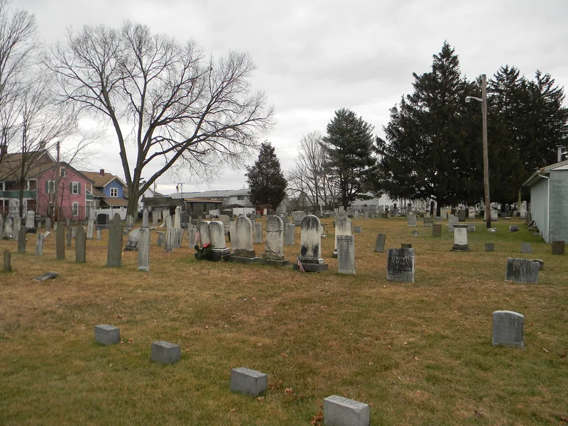
Riverside Cemetery occupies six acres beside the Susquehanna River in Endicott, New York. The ground was used for the first burial in 1792, later passed to a Dutch Reformed congregation and then a Presbyterian one, and was formally set apart as a cemetery in 1872. It served as the main burial place for the towns of Union and Vestal. The grounds are flat and open, with a grid-like layout and markers ranging from early limestone stones, some by the carver Jonas W. Stewart, to obelisks, columns and six stone vaults built between 1888 and 1908. Nearly six thousand burials include Revolutionary War settlers, Huguenot families such as the Mersereaus, local doctors, merchants and officials, and veterans of seven wars. Listing recognises the cemetery as a record of Union's settlement and growth, including the village absorbed into Endicott in the early twentieth century. Burials continue today.
Significance in brief: The nomination argues the cemetery is significant for its link to the early settlement and development of the historic town of Union. It was the main burial ground for Union and Vestal and holds nearly six thousand interments over more than two centuries. Its graves and markers record the origins, families and social history of the area, including the village of Union, which no longer exists as a political entity.
Machine-generated summary. This summary was generated by a language model from the official nomination document and has not been reviewed line by line by an editor. It may contain errors. Check the source document before relying on any detail. Source: nomination document (PDF) · National Archives catalog entry. NRHP reference 04000824, listed August 11, 2004. Summary generated October 2026 (model claude-sonnet-5-5, prompt v1.0-2026-10-29, confidence high).
Key facts
| Address | 400 Vestal Ave., Endicott |
|---|---|
| County | Broome County |
| Listed | August 11, 2004 |
| Reference number | 04000824 |
| Resource type | Site |
| Period of significance | 1791-1954 |
| Architectural style | no style |
| Criteria |
|
| Areas of significance | Exploration/Settlement, Community Planning and Development |
| Level of significance | Local |
| Status (as stated in the nomination) | The cemetery continues in use, with the newest burials in the far western plots and the Z plots. It has one non-historic concrete block office and equipment building from 1970. |
| Acreage | 6 |
| Coordinates | 42.09365, -76.05839 (NPS GIS) |
What listing means for this property
Sites (archaeological sites, battlefields, landscapes) are often listed with a restricted address to protect them from looting or disturbance. Listing is honorary for private owners; federal undertakings on or near the site go through Section 106 review, and state laws may protect burials and artefacts regardless of listing.
General information, not legal or tax advice. Rules change; confirm with your State Historic Preservation Office or a qualified adviser.
Sources and further reading
- National Park Service, National Register of Historic Places database (snapshot May 2026), reference 04000824.
- Nomination form (PDF, National Archives) — catalog entry
- Wikipedia article (used for cross-checking only; text not reproduced here)
- Wikidata Q7338436
- This listing as JSON
Last updated October 2026. Found an error? See the editorial policy for how to report it.