New Utrecht Reformed Church Complex (Boundary Increase)
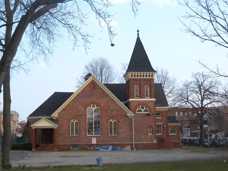

Why it's listed
About an acre in size, this cemetery sits at the west end of a Bensonhurst block in Brooklyn, two blocks from the New Utrecht Reformed Church listed in 1980. Burials began around 1653, when New Utrecht's Dutch settlers buried their dead near their houses. The ground later became the churchyard of a stone church built in 1700 and replaced in 1828. The cemetery holds roughly 1,220 known burials, including 23 veterans and the monument of General Nathaniel Woodhull, who died in 1776 after the Battle of Long Island. Headstones face east and progress from red sandstone to marble and then polished granite. Two unmarked areas are recorded: one for African American burials, partly lost beneath 16th Avenue, and a mass grave of American soldiers. Its period of significance runs from about 1653 to 1950, and it is recognized as one of the earliest Dutch settlement-era cemeteries in New York City.
Significance in brief: The nomination argues the cemetery is an integral part of the church's history and one of the earliest Dutch settlement-era cemeteries in New York City. It is significant under Criterion A for Exploration/Settlement. The period of significance runs from the c. 1653 founding to 1950, when most burials had occurred.
Machine-generated summary. This summary was generated by a language model from the official nomination document and has not been reviewed line by line by an editor. It may contain errors. Check the source document before relying on any detail. Source: nomination document (PDF) · National Archives catalog entry. NRHP reference 01000126, listed March 5, 2001. Summary generated October 2026 (model claude-sonnet-5-5, prompt v1.0-2026-10-29, confidence medium).
Key facts
| Address | 8523 16th Ave., Brooklyn |
|---|---|
| County | Brooklyn |
| Listed | March 5, 2001 |
| Reference number | 01000126 |
| Resource type | Site |
| Period of significance | c. 1653-1950 |
| Criteria |
|
| Areas of significance | Exploration/Settlement |
| Level of significance | Local |
| Status (as stated in the nomination) | The cemetery is closed to new burials apart from a few reserved spaces for urns. A chain link fence replaced the original iron fence in the 1960s. |
| Acreage | 0.9 |
| Coordinates | 40.61064, -74.00604 (NPS GIS) |
What listing means for this property
Sites (archaeological sites, battlefields, landscapes) are often listed with a restricted address to protect them from looting or disturbance. Listing is honorary for private owners; federal undertakings on or near the site go through Section 106 review, and state laws may protect burials and artefacts regardless of listing.
General information, not legal or tax advice. Rules change; confirm with your State Historic Preservation Office or a qualified adviser.
Sources and further reading
- National Park Service, National Register of Historic Places database (snapshot May 2026), reference 01000126.
- Nomination form (PDF, National Archives) — catalog entry
- Wikipedia article (used for cross-checking only; text not reproduced here)
- Wikidata Q12063902
- This listing as JSON
Last updated October 2026. Found an error? See the editorial policy for how to report it.