Indian Cemetery, Old
Also known as: Old Cemetery

Why it's listed
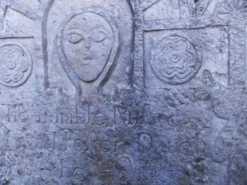
Old Indian Cemetery occupies about one acre on a slope above Wickaboag Pond on Cottage Street in West Brookfield, Massachusetts. Enclosed by a 36-inch dry-laid fieldstone wall and shaded by tall pines, it holds roughly 186 gravestones of slate, sandstone, marble, schist and fieldstone. Burials began around 1710, and its name comes from the Haymakers Monument of 1912, which commemorates settlers killed in an Indian raid. Despite the name, no Native Americans are recorded as buried there. The graves include Col. Jedediah Foster, soldiers of the French and Indian and Revolutionary wars, and members of early town families such as Adams, Foster, Gilbert and Wood. The cemetery was listed for its role in local history and for stones by carvers including John Buckland, Daniel Hastings, the Sikes brothers, William Young and the Soule family. Its layout and setting have changed little over nearly three centuries. The site also lies within a known ancient Native American settlement area.
Significance in brief: The cemetery is West Brookfield's second public burial ground and holds the graves of early families and of soldiers from the French and Indian and Revolutionary wars. It also contains work by many well-known New England gravestone carvers, and it has changed very little since the colonial period.
Machine-generated summary. This summary was generated by a language model from the official nomination document and has not been reviewed line by line by an editor. It may contain errors. Check the source document before relying on any detail. Source: nomination document (PDF) · National Archives catalog entry. NRHP reference 06000400, listed May 17, 2006. Summary generated October 2026 (model claude-sonnet-5-5, prompt v1.0-2026-10-29, confidence medium).
Key facts
| Address | 50 Cottage St., West Brookfield |
|---|---|
| County | Worcester County |
| Listed | May 17, 2006 |
| Reference number | 06000400 |
| Resource type | Site |
| Period of significance | 1710-1956 |
| Criteria |
|
| Areas of significance | Art, Community Planning and Development, Social History |
| Level of significance | Local |
| Status (as stated in the nomination) | Still used as a cemetery. Markers are in relatively good condition, though some need conservation. |
| Acreage | 1 |
| Coordinates | 42.23890, -72.14543 (NPS GIS) |
What listing means for this property
Sites (archaeological sites, battlefields, landscapes) are often listed with a restricted address to protect them from looting or disturbance. Listing is honorary for private owners; federal undertakings on or near the site go through Section 106 review, and state laws may protect burials and artefacts regardless of listing.
General information, not legal or tax advice. Rules change; confirm with your State Historic Preservation Office or a qualified adviser.
Sources and further reading
- National Park Service, National Register of Historic Places database (snapshot May 2026), reference 06000400.
- Nomination form (PDF, National Archives) — catalog entry
- Wikipedia article (used for cross-checking only; text not reproduced here)
- Wikidata Q7084266
- This listing as JSON
Last updated October 2026. Found an error? See the editorial policy for how to report it.