Blackstone Canal

Why it's listed
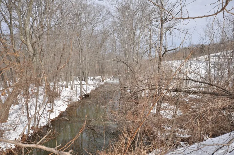
This 3.5-mile stretch of the Blackstone Canal runs through Northbridge and Uxbridge, west of the Blackstone River. It is part of a 45-mile waterway completed in 1828 between Worcester and Providence, with 27.5 miles in Massachusetts. The canal was meant to connect inland markets with coastal trade, an idea discussed since the 1790s. The route was surveyed in 1822, and the company cost $750,000, with two-thirds of the stock bought by Rhode Island investors. The nominated section keeps its trough and towpath on the east side, a granite lock that is largely intact, and the foundation of a trading house associated with merchant Israel Plummer, dated to 1836-37. Parts of the towpath are lost under Rice City Pond, and a dam and water gates near Hartford Road were added after canal use ended. The surrounding land is wooded and marshy, and it has seen few intrusions beyond the canal itself.
Significance in brief: The nomination presents the canal as an early transportation route linking inland Worcester with the coastal trading center of Providence, built after decades of planning and strong regional support. The nominated section keeps the canal trough, towpath, a lock, and a trading house foundation in a largely natural setting with few modern intrusions.
Machine-generated summary. This summary was generated by a language model from the official nomination document and has not been reviewed line by line by an editor. It may contain errors. Check the source document before relying on any detail. Source: nomination document (PDF) · National Archives catalog entry. NRHP reference 73000328, listed February 6, 1973. Summary generated October 2026 (model claude-sonnet-5-5, prompt v1.0-2026-10-29, confidence medium).
Key facts
| Address | E of MA 122 between Northbridge and Uxbridge, Northbridge and vicinity |
|---|---|
| County | Worcester County |
| Listed | February 6, 1973 |
| Reference number | 73000328 |
| Resource type | Structure |
| Period of significance | 1822-28 |
| Areas of significance | Commerce, Transportation |
| Level of significance | State, Local |
| Status (as stated in the nomination) | Condition is marked good and altered. The canal is listed as having no present use and as open space, with parts obliterated by Rice City Pond and a broken dam. |
| Acreage | 189 |
| Coordinates | 42.10657, -71.62800 (NPS GIS) |
What listing means for this property
National Register listing is honorary: it recognises significance and does not restrict what a private owner may do without federal money or permits. It unlocks the 20% federal rehabilitation tax credit for income-producing buildings, state credits in many states, and Section 106 review when federal agencies are involved. See what listing means in practice.
General information, not legal or tax advice. Rules change; confirm with your State Historic Preservation Office or a qualified adviser.
Sources and further reading
- National Park Service, National Register of Historic Places database (snapshot May 2026), reference 73000328.
- Nomination form (PDF, National Archives) — catalog entry
- Wikidata Q57084142
- This listing as JSON
Last updated October 2026. Found an error? See the editorial policy for how to report it.