Ammidown-Harding Farmhouse

Why it's listed
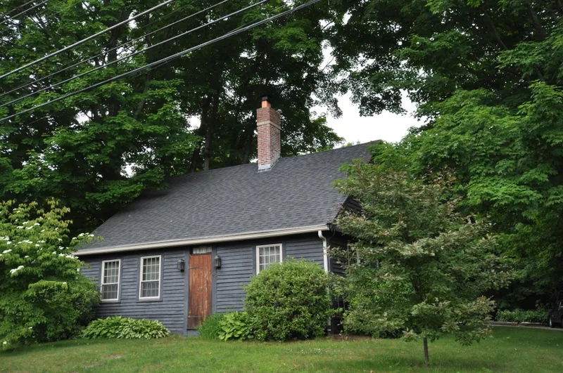
Set close to the road on Lebanon Hill Road in Southbridge, this one-and-a-half story farmhouse dates from before 1796. It has four bays, a central chimney, clapboard siding and overhanging gables on the sides. Original details include a three-light transom over the main entrance and a six-panel door with moulded panels. A 19th-century barn with a cupola, bracketed eaves and tongue-and-groove battened doors stands at the rear. Lebanon Hill Road began as an Indian trail and was among the earliest roads in the town, and a farmhouse existed near this spot on the 1796 survey, mapped in 1812. Deacon Cyrus Ammidown, an early Baptist church deacon, owned the place, followed by Elbridge G. Harding, who held it by 1855. The house is described as the least altered pre-1816 residence left in Southbridge. It is recognized for its link to local settlement and farming and for its regionally notable Cape form.
Significance in brief: The nomination argues the house is the least altered pre-1816 residence remaining in Southbridge and reflects the town's settlement period and its lasting agricultural economy. It is also considered a regionally significant example of the four-bay Cape Cod house form. It is cited under criteria A and C at the local level.
Machine-generated summary. This summary was generated by a language model from the official nomination document and has not been reviewed line by line by an editor. It may contain errors. Check the source document before relying on any detail. Source: nomination document (PDF) · National Archives catalog entry. NRHP reference 89000552, listed June 22, 1989. Summary generated October 2026 (model claude-sonnet-5-5, prompt v1.0-2026-10-29, confidence high).
Key facts
| Address | 83 Lebanon Hill Rd., Southbridge |
|---|---|
| County | Worcester County |
| Listed | June 22, 1989 |
| Reference number | 89000552 |
| Resource type | Building |
| Architectural style | Cape-type New England (timber frame vernacular) |
| Criteria |
|
| Areas of significance | Agriculture, Architecture |
| Level of significance | Local |
| Status (as stated in the nomination) | Condition listed as excellent; in use as a residence. Central chimney was made smaller in the mid-19th century. |
| Acreage | 0.9 |
| Coordinates | 42.06030, -72.03435 (NPS GIS) |
What listing means for this property
National Register listing is honorary: it recognises significance and does not restrict what a private owner may do without federal money or permits. It unlocks the 20% federal rehabilitation tax credit for income-producing buildings, state credits in many states, and Section 106 review when federal agencies are involved. See what listing means in practice.
General information, not legal or tax advice. Rules change; confirm with your State Historic Preservation Office or a qualified adviser.
Sources and further reading
- National Park Service, National Register of Historic Places database (snapshot May 2026), reference 89000552.
- Nomination form (PDF, National Archives) — catalog entry
- Wikipedia article (used for cross-checking only; text not reproduced here)
- Wikidata Q4747239
- This listing as JSON
Last updated October 2026. Found an error? See the editorial policy for how to report it.