Long Wharf and Custom House Block
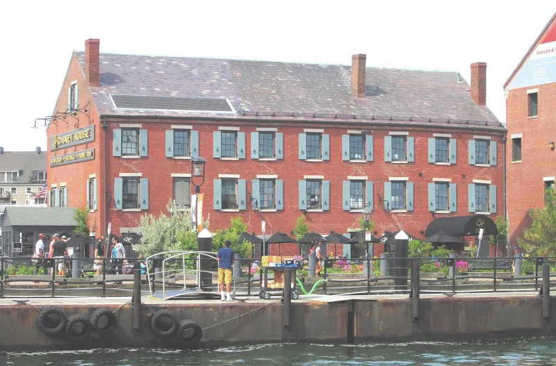

Why it's listed
Long Wharf extends into Boston Harbor from the foot of State Street. It was authorized in 1710 to a group headed by Captain Oliver Noyes and grew to roughly half a mile long, letting ships unload directly into warehouses. It became the center of Boston's maritime trade and, by the late 1700s, the most prominent of the city's 80 wharves. Later projects, including Commercial Street, Atlantic Avenue and repeated widenings, shortened and reshaped it. Today it measures about 640 feet by 280 feet, and older granite bulkheads and possible timber remains lie beneath the paving. Two buildings survive. The Custom House Block, completed in 1848, is a Greek Revival warehouse row with a granite front and brick ends, five stories in the center. The Chart House, a brick warehouse of 3.5 stories dating from the 1830s and possibly partly from 1763, shows the smaller earlier warehouse type. The wharf was recognized for its role in colonial and 19th-century trade.
Significance in brief: Long Wharf was the center of Boston's maritime trade and, by the end of the 18th century, the most prominent of the city's 80 wharves. Boston was the largest colonial American port until 1756. The Custom House Block and Chart House help the wharf keep its historic character and show monumental granite and earlier warehouse building forms.
Machine-generated summary. This summary was generated by a language model from the official nomination document and has not been reviewed line by line by an editor. It may contain errors. Check the source document before relying on any detail. Source: nomination document (PDF) · National Archives catalog entry. NRHP reference 66000768, listed November 13, 1966. Summary generated October 2026 (model claude-sonnet-5-5, prompt v1.0-2026-10-29, confidence medium).
Key facts
| Address | Foot of State St., Boston |
|---|---|
| County | Suffolk County |
| Listed | November 13, 1966 |
| Reference number | 66000768 |
| Resource type | Structure |
| Period of significance | c. 1710-1855 |
| Architect / builder | Oliver Noyes (?) |
| Architectural style | Greek Revival (Custom House Block); no style (wharf) |
| Criteria |
|
| Areas of significance | Commerce |
| Level of significance | National |
| National Historic Landmark | Yes, designated November 13, 1966 |
| Status (as stated in the nomination) | The wharf is used by excursion boats and water taxis, with a parking lot on the north side. The Custom House Block was renovated in the 1970s for shops, offices and apartments, and the Chart House became a restaurant in 1973. |
| Acreage | 1.5 |
| Coordinates | 42.36017, -71.04869 (NPS GIS) |
What listing means for this property
National Register listing is honorary for a privately owned home: it does not by itself restrict what an owner may do with their own money, and it does not require public access. Restrictions come from local landmark or historic-district ordinances, which are separate (how they differ).
Owner-occupied houses are not eligible for the 20% federal rehabilitation tax credit, which applies to income-producing buildings, but many states offer credits for homeowners. Listing also opens the door to preservation easements and to buying a plaque. Start with what listing means for homeowners, renovating a listed house and selling one.
General information, not legal or tax advice. Rules change; confirm with your State Historic Preservation Office or a qualified adviser.
Sources and further reading
- National Park Service, National Register of Historic Places database (snapshot May 2026), reference 66000768.
- Nomination form (PDF, National Archives) — catalog entry
- Wikipedia article (used for cross-checking only; text not reproduced here)
- Wikidata Q6673406
- This listing as JSON
Last updated October 2026. Found an error? See the editorial policy for how to report it.