West Roxbury Parkway, Metropolitan Park System of Greater Boston

Why it's listed
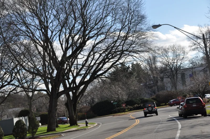
West Roxbury Parkway is a roughly 3.3-mile connecting road running from Washington Street in Boston's West Roxbury section to Hammond Pond Parkway and Newton Street in Brookline. It includes East Border, West Border and Bellevue Hill roads, a 1920 concrete railroad bridge and rotaries built in the 1930s. Land takings began in 1894, and the road was built in four sections between 1919 and 1929 through a joint effort of the Metropolitan Parks Commission and the Boston Parks Commission. Boston built and maintained it, but it followed Metropolitan Park System design standards. The parkway was meant to link state reservations such as Stony Brook and the Blue Hills with city parks including the Arnold Arboretum, Franklin Park and Jamaica Pond. It retains its original layout, granite curbing and landscaped edges. It was recognized for its role in community planning, engineering, landscape architecture and transportation, as a well-preserved example of a connecting parkway.
Significance in brief: It is an intact example of a connecting parkway built to Metropolitan Parks Commission standards, linking state reservations such as Stony Brook with Boston city parks. It is significant for community planning and development, engineering, landscape architecture and transportation at the state level. The 1930s rotaries and border roads reflect later traffic changes.
Machine-generated summary. This summary was generated by a language model from the official nomination document and has not been reviewed line by line by an editor. It may contain errors. Check the source document before relying on any detail. Source: nomination document (PDF) · National Archives catalog entry. NRHP reference 05001528, listed January 19, 2006. Summary generated October 2026 (model claude-sonnet-5-5, prompt v1.0-2026-10-29, confidence medium).
Key facts
| Address | West Roxbury Parkway, Bellevue Hill, E. Border, W. Border Rds., Brookline |
|---|---|
| County | Norfolk County |
| Listed | January 19, 2006 |
| Reference number | 05001528 |
| Resource type | District |
| Period of significance | 1894-1956 |
| Architect / builder | Charles Eliot, Olmsted Brothers |
| Criteria |
|
| Areas of significance | Community Planning and Development, Engineering, Landscape Architecture, Transportation |
| Level of significance | State |
| Status (as stated in the nomination) | Still a heavily traveled parkway in public park and road use, administered by the state Department of Conservation and Recreation. |
| Coordinates | 42.30426, -71.15203 (NPS GIS) |
What listing means for this property
This is a historic district. Buildings within its boundary are either contributing (they add to the district's significance) or non-contributing. Owners of contributing income-producing buildings can claim the 20% federal rehabilitation tax credit; homeowners should look at state credits. National Register districts impose no design review by themselves; a local historic district ordinance, if one exists, does (the difference explained).
General information, not legal or tax advice. Rules change; confirm with your State Historic Preservation Office or a qualified adviser.
Sources and further reading
- National Park Service, National Register of Historic Places database (snapshot May 2026), reference 05001528.
- Nomination form (PDF, National Archives) — catalog entry
- Wikipedia article (used for cross-checking only; text not reproduced here)
- Wikidata Q1193015
- This listing as JSON
Last updated October 2026. Found an error? See the editorial policy for how to report it.