Quincy Shore Drive

Why it's listed
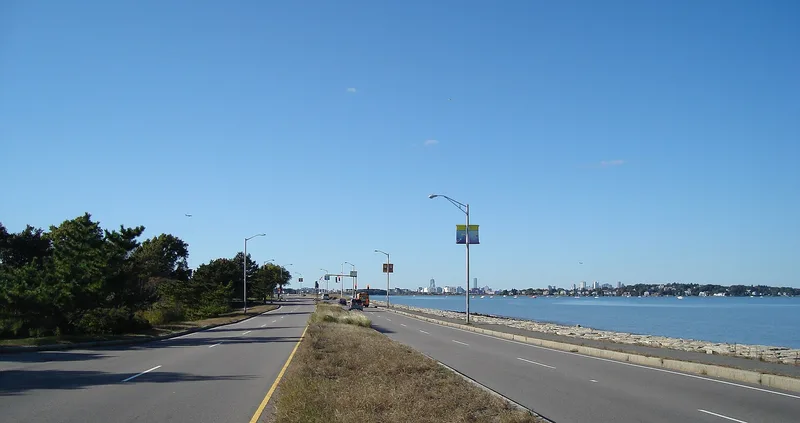
Quincy Shore Drive is a four-mile parkway along the shore of Quincy Bay, one of eight ocean parkways in Boston's metropolitan park system. It has three segments: two tree-lined residential connectors and a central shoreline stretch with views toward Boston and the harbor islands. Planning followed arguments that public ownership of the shoreline would protect access and keep the coast free of encroachment. The Metropolitan Park Commission acquired most of the land by 1900 and began construction in 1903. Early work included a roadway and piers for two yacht clubs. Later work added a concrete bridge over Blacks Creek in 1915-1916 and tide gates installed in 1911, which controlled water flow into the adjacent marshes. Contributing features include the bridge, tide gates, dam, medians and tree plantings. Later additions such as wing walls built in 1963 are not counted. The parkway is listed as a district for its role in providing public shoreline access.
Significance in brief: It is one of eight ocean parkways in Boston's metropolitan park system, built to give the public access to the shoreline and views of Boston Harbor. It also served as a wetland control structure through its bridge, tide gates and dam at Blacks Creek. The remaining roadway keeps many features of an MDC ocean parkway.
Machine-generated summary. This summary was generated by a language model from the official nomination document and has not been reviewed line by line by an editor. It may contain errors. Check the source document before relying on any detail. Source: nomination document (PDF) · National Archives catalog entry. NRHP reference 03000575, listed June 23, 2003. Summary generated October 2026 (model claude-sonnet-5-5, prompt v1.0-2026-10-29, confidence medium).
Key facts
| Address | Quincy Shore Drive, Quincy |
|---|---|
| County | Norfolk County |
| Listed | June 23, 2003 |
| Reference number | 03000575 |
| Resource type | District |
| Architect / builder | Metropolitan Park Commission (MPC) |
| Areas of significance | Community Planning and Development, Conservation, Engineering, Entertainment/Recreation, Landscape Architecture, Transportation |
| Level of significance | State |
| Status (as stated in the nomination) | Still in use as a parkway and road; the original Neponset end and Atlantic Street connection no longer exist. |
| Acreage | 23 |
| Coordinates | 42.27389, -71.00116 (NPS GIS) |
What listing means for this property
This is a historic district. Buildings within its boundary are either contributing (they add to the district's significance) or non-contributing. Owners of contributing income-producing buildings can claim the 20% federal rehabilitation tax credit; homeowners should look at state credits. National Register districts impose no design review by themselves; a local historic district ordinance, if one exists, does (the difference explained).
General information, not legal or tax advice. Rules change; confirm with your State Historic Preservation Office or a qualified adviser.
Sources and further reading
- National Park Service, National Register of Historic Places database (snapshot May 2026), reference 03000575.
- Nomination form (PDF, National Archives) — catalog entry
- Wikipedia article (used for cross-checking only; text not reproduced here)
- Wikidata Q1153288
- This listing as JSON
Last updated October 2026. Found an error? See the editorial policy for how to report it.