Paul's Bridge

Why it's listed
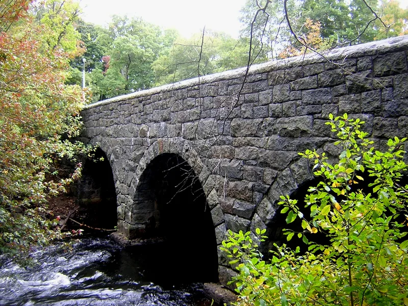
Paul's Bridge carries the Neponset Valley Parkway over the Neponset River between Milton and the Readville section of Boston. Built in 1849, the 88-foot structure has three round arches of unmortared stone, each spanning 20 feet at the springline. It is the third bridge on the site. An earlier span, called Hubbard's Bridge, was rebuilt in 1759 at a cost shared among towns by their province tax. By 1807 it had been renamed for the owner of adjacent land in Dedham. In the 18th century it served as the only link between Milton and Dedham and as a crossing for local farmers. Between 1932 and 1935 the bridge was widened and given solid stone parapets, with the south elevation rebuilt about 17 feet southward using the same blocks. Arthur A. Shurcliff directed the redesign. The bridge lies within the Neponset River Reservation, a green link between the Stoney Brook and Blue Hills Reservations designed by Olmsted, Olmsted and Eliot. It remains publicly owned and in use.
Significance in brief: It is the third bridge on this site and one of three Milton crossings of the Neponset River in the 18th century, then the only link between Milton and Dedham. It lies within the Neponset River Reservation, planned by Olmsted, Olmsted and Eliot, and its 1932-35 redesign was by landscape architect Arthur A. Shurcliff.
Machine-generated summary. This summary was generated by a language model from the official nomination document and has not been reviewed line by line by an editor. It may contain errors. Check the source document before relying on any detail. Source: nomination document (PDF) · National Archives catalog entry. NRHP reference 72000140, listed December 11, 1972. Summary generated October 2026 (model claude-sonnet-5-5, prompt v1.0-2026-10-29, confidence medium).
Key facts
| Address | Neponset Valley Pkwy., over the Neponset River, Milton |
|---|---|
| County | Norfolk County |
| Listed | December 11, 1972 |
| Reference number | 72000140 |
| Resource type | Structure |
| Period of significance | 1849 |
| Architect / builder | Arthur A. Shurcliff (1932-35 redesign) |
| Areas of significance | Landscape Architecture, Transportation |
| Level of significance | Local |
| Status (as stated in the nomination) | Listed as in good condition, altered, on its original site, and in use for transportation as part of the Neponset Valley Parkway. |
| Acreage | 8 |
| Within district | Neponset Valley Parkway, Metorpolitan Park System of Greater Boston |
| Coordinates | 42.23458, -71.12269 (NPS GIS) |
What listing means for this property
For a publicly owned building or structure, listing mainly matters when federal funds, permits or licences are involved: projects then go through Section 106 review so effects on the property are considered. Listing also strengthens applications for preservation grants and, for leased income-producing uses, can enable the federal rehabilitation tax credit.
General information, not legal or tax advice. Rules change; confirm with your State Historic Preservation Office or a qualified adviser.
Sources and further reading
- National Park Service, National Register of Historic Places database (snapshot May 2026), reference 72000140.
- Nomination form (PDF, National Archives) — catalog entry
- Wikipedia article (used for cross-checking only; text not reproduced here)
- Wikidata Q7148894
- This listing as JSON
Last updated October 2026. Found an error? See the editorial policy for how to report it.