Moswetuset Hummock

Why it's listed
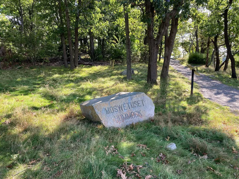
Moswetuset Hummock is a small, arrow-shaped promontory of about two acres in the northern part of Quincy, reached from Squantum Street across a short, narrow neck. Quincy Bay and salt marshes surround it, the waters where Native people fished and the marshes that sheltered them. In the early 1600s the hill was the chief seat of Chicatabot, Sachem of the Massachusetts Indians. Its name, recorded in Neal's History of New England of 1747, means a hill shaped like an arrowhead, and the tribe's name is the source of the name Massachusetts. The nomination describes it as the only surviving memorial of that tribe and as one of the few important Indian sites in New England left unchanged since Native occupation. The vegetation is described as much the same as in the seventeenth century. Four stone bounds mark its north, east and south edges, and a monument placed by the Squantum Women's Club stands on the south side. The state owns the site, which serves as a park.
Significance in brief: The nomination calls it the only surviving memorial of the tribe from which the Colony, Province and Commonwealth of Massachusetts took their name. In the early 1600s it was the chief seat of Chicatabot, Sachem of the Massachusetts Indians. It is also described as one of the few important Indian sites in New England that remains unchanged since Native occupation.
Machine-generated summary. This summary was generated by a language model from the official nomination document and has not been reviewed line by line by an editor. It may contain errors. Check the source document before relying on any detail. Source: nomination document (PDF) · National Archives catalog entry. NRHP reference 70000094, listed July 1, 1970. Summary generated October 2026 (model claude-sonnet-5-5, prompt v1.0-2026-10-29, confidence medium).
Key facts
| Address | Squantum St., near jct. with Morrissey Rd., Quincy |
|---|---|
| County | Norfolk County |
| Listed | July 1, 1970 |
| Reference number | 70000094 |
| Resource type | Site |
| Period of significance | 17th Century |
| Areas of significance | Historic - Aboriginal, Exploration/Settlement |
| Level of significance | State |
| Status (as stated in the nomination) | Condition marked good and original site; the form states the vegetation remains much as it was when Native people occupied it. Owned by the Commonwealth of Massachusetts and used as a park. |
| Acreage | 1.9 |
| Coordinates | 42.28948, -71.02047 (NPS GIS) |
What listing means for this property
Sites (archaeological sites, battlefields, landscapes) are often listed with a restricted address to protect them from looting or disturbance. Listing is honorary for private owners; federal undertakings on or near the site go through Section 106 review, and state laws may protect burials and artefacts regardless of listing.
General information, not legal or tax advice. Rules change; confirm with your State Historic Preservation Office or a qualified adviser.
Sources and further reading
- National Park Service, National Register of Historic Places database (snapshot May 2026), reference 70000094.
- Nomination form (PDF, National Archives) — catalog entry
- Wikipedia article (used for cross-checking only; text not reproduced here)
- Wikidata Q6917049
- This listing as JSON
Last updated October 2026. Found an error? See the editorial policy for how to report it.