Shirley Center Historic District

Why it's listed
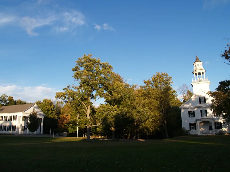
Shirley Center is the earliest settlement core of Shirley, Massachusetts, a 72-acre area of farmhouses, civic buildings and open spaces arranged around the Town Common. Most of the 42 contributing resources are residential, from the 1755 Adams House to Federal, Greek Revival and Italianate dwellings, with a single 1920s bungalow. Institutional landmarks include the First Parish Church, first built in 1773 and moved and remodeled in 1851, and the Greek Revival Town Hall of 1848. The Center Cemetery, the Town Pound and the Common itself are also part of the district. The area was listed for its local importance in architecture, community planning and agriculture between 1753 and 1930. After Shirley separated from Groton in 1753, the Center remained the civic hub while mills and the railroad grew up to the south. That isolation preserved the curving roads, stone walls, mature trees and irregular building setbacks of a rural farming community.
Significance in brief: The nomination argues it is one of the best local examples of a well-preserved 18th and 19th-century rural New England town center radiating from a civic meetinghouse core. It was the early colonial settlement focus of Shirley and stayed a civic and farming center while industry developed to the south. The buildings are architecturally cohesive, and the street pattern is largely undisturbed.
Machine-generated summary. This summary was generated by a language model from the official nomination document and has not been reviewed line by line by an editor. It may contain errors. Check the source document before relying on any detail. Source: nomination document (PDF) · National Archives catalog entry. NRHP reference 88001454, listed September 1, 1988. Summary generated October 2026 (model claude-sonnet-5-5, prompt v1.0-2026-10-29, confidence medium).
Key facts
| Address | Brown, Center, Horsepond, Parker and Whitney Rds., Shirley |
|---|---|
| County | Middlesex County |
| Listed | September 1, 1988 |
| Reference number | 88001454 |
| Resource type | District |
| Period of significance | 1753-1930 |
| Architect / builder | various |
| Architectural style | Colonial: Georgian; Early Republic: Federal; Mid-19th Century: Greek Revival; Late Victorian: Italianate; Bungalow |
| Criteria |
|
| Areas of significance | Community Planning and Development, Agriculture, Architecture, Social History |
| Level of significance | Local |
| Status (as stated in the nomination) | Nearly all buildings retain their original function; the Brick School House has been converted to a residence and the Whitney Store is used only as a residence. |
| Acreage | 72 |
| Coordinates | 42.57317, -71.65044 (NPS GIS) |
What listing means for this property
This is a historic district. Buildings within its boundary are either contributing (they add to the district's significance) or non-contributing. Owners of contributing income-producing buildings can claim the 20% federal rehabilitation tax credit; homeowners should look at state credits. National Register districts impose no design review by themselves; a local historic district ordinance, if one exists, does (the difference explained).
General information, not legal or tax advice. Rules change; confirm with your State Historic Preservation Office or a qualified adviser.
Sources and further reading
- National Park Service, National Register of Historic Places database (snapshot May 2026), reference 88001454.
- Nomination form (PDF, National Archives) — catalog entry
- Wikipedia article (used for cross-checking only; text not reproduced here)
- Wikidata Q7498716
- This listing as JSON
Last updated October 2026. Found an error? See the editorial policy for how to report it.