Old Burying Ground

Why it's listed
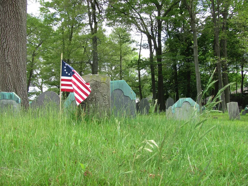
Stoneham's Old Burying Ground is a town-owned cemetery of about one acre at Pleasant and William Streets. The land was bought from John Hay in July 1726, and burials ran from 1728 until around 1850. Roughly 150 stones remain, mostly slate or marble, with arched or rectangular tops. Carved motifs follow popular 18th and early 19th century patterns, including winged death's heads, cherubs, urns and willows. Several crypts are set into the granite retaining wall around the grounds, which are flat and shaded by mature deciduous trees. The cemetery was listed because it is the only surviving piece of Stoneham's original town center, which once included a church and school. It holds the graves of most of the town's early settlers and keeps its original location, setting, design, materials and workmanship. Condition is fair to poor: weathering has damaged many slate stones, and about a quarter lean or have fallen.
Significance in brief: The nomination argues it is the only surviving part of Stoneham's original town center, which also had a church and school. It holds the graves of most of the town's early settlers. It retains integrity of location, design, setting, materials and workmanship.
Machine-generated summary. This summary was generated by a language model from the official nomination document and has not been reviewed line by line by an editor. It may contain errors. Check the source document before relying on any detail. Source: nomination document (PDF) · National Archives catalog entry. NRHP reference 84002766, listed April 13, 1984. Summary generated October 2026 (model claude-sonnet-5-5, prompt v1.0-2026-10-29, confidence medium).
Key facts
| Address | Pleasant and William Sts., Stoneham |
|---|---|
| County | Middlesex County |
| Listed | April 13, 1984 |
| Reference number | 84002766 |
| Resource type | Site |
| Criteria |
|
| Areas of significance | Social History |
| Level of significance | Local |
| Status (as stated in the nomination) | Condition fair to poor; slate stones are weathered and some badly deteriorated. About a quarter of the roughly 150 stones are leaning or fallen, though most inscriptions are fairly legible. |
| Acreage | 1 |
| Coordinates | 42.48146, -71.09623 (NPS GIS) |
What listing means for this property
Sites (archaeological sites, battlefields, landscapes) are often listed with a restricted address to protect them from looting or disturbance. Listing is honorary for private owners; federal undertakings on or near the site go through Section 106 review, and state laws may protect burials and artefacts regardless of listing.
General information, not legal or tax advice. Rules change; confirm with your State Historic Preservation Office or a qualified adviser.
Sources and further reading
- National Park Service, National Register of Historic Places database (snapshot May 2026), reference 84002766.
- Nomination form (PDF, National Archives) — catalog entry
- Wikipedia article (used for cross-checking only; text not reproduced here)
- Wikidata Q7083567
- This listing as JSON
Last updated October 2026. Found an error? See the editorial policy for how to report it.